MyTopo
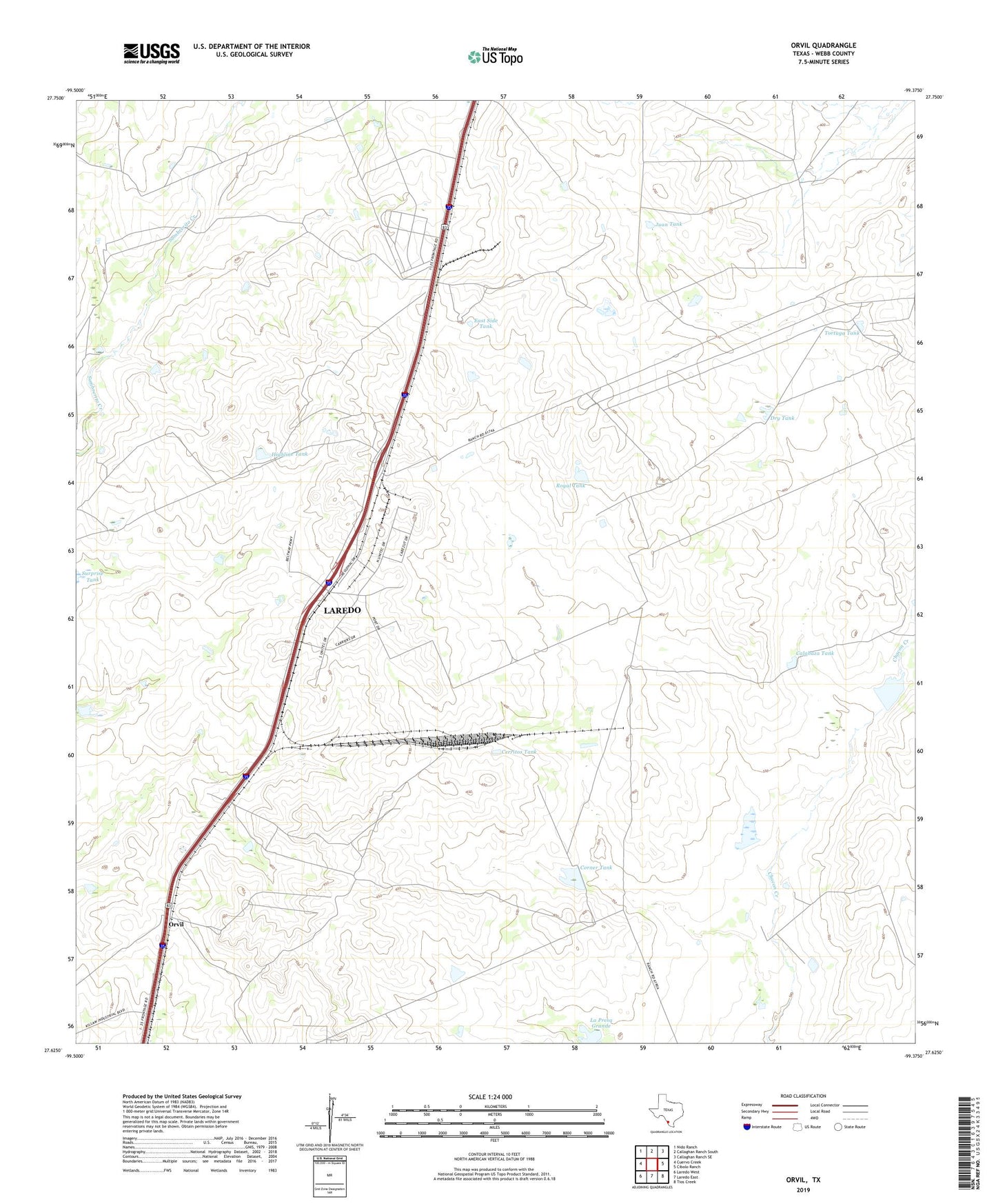
Orvil Texas US Topo Map
Couldn't load pickup availability
2019 topographic map quadrangle Orvil in the state of Texas. Scale: 1:24000. Based on the newly updated USGS 7.5' US Topo map series, this map is in the following counties: Webb. The map contains contour data, water features, and other items you are used to seeing on USGS maps, but also has updated roads and other features. This is the next generation of topographic maps. Printed on high-quality waterproof paper with UV fade-resistant inks.
Quads adjacent to this one:
West: Cuervo Creek
Northwest: Nido Ranch
North: Callaghan Ranch South
Northeast: Callaghan Ranch SE
East: Cibolo Ranch
Southeast: Tios Creek
South: Laredo East
Southwest: Laredo West
Contains the following named places: Bull Trap Tank, Calabaza Tank, Cerritos Tank, Corner Tank, Deer Trap Tank, Dry Tank, East Side Tank, El Jano Windmill, Highline Tank, Juan Tank, La Coma Windmill, La Presa Grande, Macana Windmill, Mocho Windmill, Orvil, Orvil Windmill, Royal Tank, Tasal Windmill, Tortuga Tank