MyTopo
Palacios Texas US Topo Map
Couldn't load pickup availability
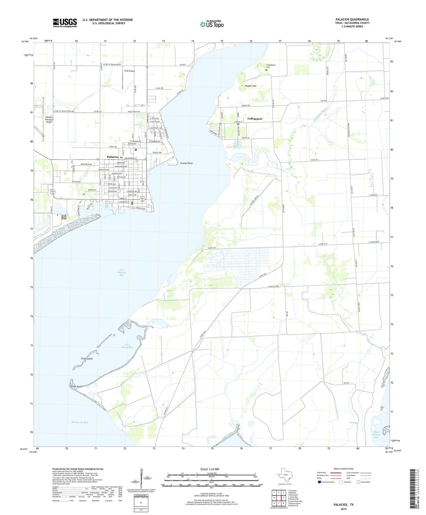
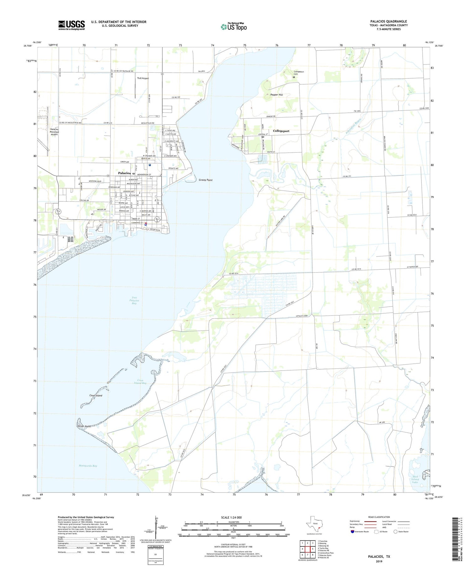
2019 topographic map quadrangle Palacios in the state of Texas. Scale: 1:24000. Based on the newly updated USGS 7.5' US Topo map series, this map is in the following counties: Matagorda. The map contains contour data, water features, and other items you are used to seeing on USGS maps, but also has updated roads and other features. This is the next generation of topographic maps. Printed on high-quality waterproof paper with UV fade-resistant inks.
Quads adjacent to this one:
West: Turtle Bay
Northwest: Francitas
North: Blessing
Northeast: Blessing SE
East: Palacios NE
Southeast: Palacios SE
South: Palacios Point
Southwest: Carancahua Pass
Contains the following named places: Camp Hulen, Central Elementary School, Church of Christ, Church of God of Prophecy, City of Palacios, Collegeport, Collegeport Cemetery, Collegeport Post Office, Coon Island, Coon Island Bay, East Bay Yacht Harbor Marina, Eastside Elementary School, First Baptist Church, Grassy Point, Matagorda County Alternative School - Palacios, Matagorda County Constable's Office Precinct 3, Matagorda County Emergency Medical Services, Oliver Point, Palacios, Palacios Area Historical Association, Palacios City Hall, Palacios Community Medical Center, Palacios Division, Palacios High School, Palacios Junior High School, Palacios Police Department, Palacios Post Office, Palacios Volunteer Fire Department, Pelican Slough, Pepper Hill, Pilgrim Rose Baptist Church, Saint Anthonys Catholic Church, Saint Johns Episcopal Church, Solid Rock Fellowship Church, Texas Baptist Encampment Church, Tres Palacios Bay, Trinity Baptist Church, Trull Airport, United Pentecostal Church, Wagner Heliport