MyTopo
Blessing SE Texas US Topo Map
Couldn't load pickup availability
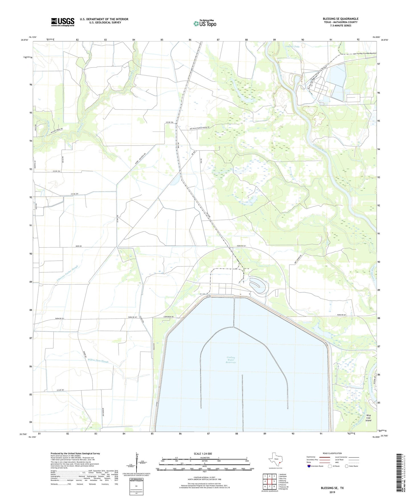
2022 topographic map quadrangle Blessing SE in the state of Texas. Scale: 1:24000. Based on the newly updated USGS 7.5' US Topo map series, this map is in the following counties: Matagorda. The map contains contour data, water features, and other items you are used to seeing on USGS maps, but also has updated roads and other features. This is the next generation of topographic maps. Printed on high-quality waterproof paper with UV fade-resistant inks.
Quads adjacent to this one:
West: Blessing
Northwest: Midfield
North: Markham
Northeast: Bay City
East: Wadsworth
Southeast: Matagorda
South: Palacios NE
Southwest: Palacios
This map covers the same area as the classic USGS quad with code o28096g1.
Contains the following named places: Ashby, Ashby Church, Compress Slough, Cooling Water Reservoir, Kelly Lake, Matagorda County, Port of Bay City, Saint Mary Church, Simpsonville, Tin Top, West Branch Colorado River