MyTopo
Pattonville Texas US Topo Map
Couldn't load pickup availability
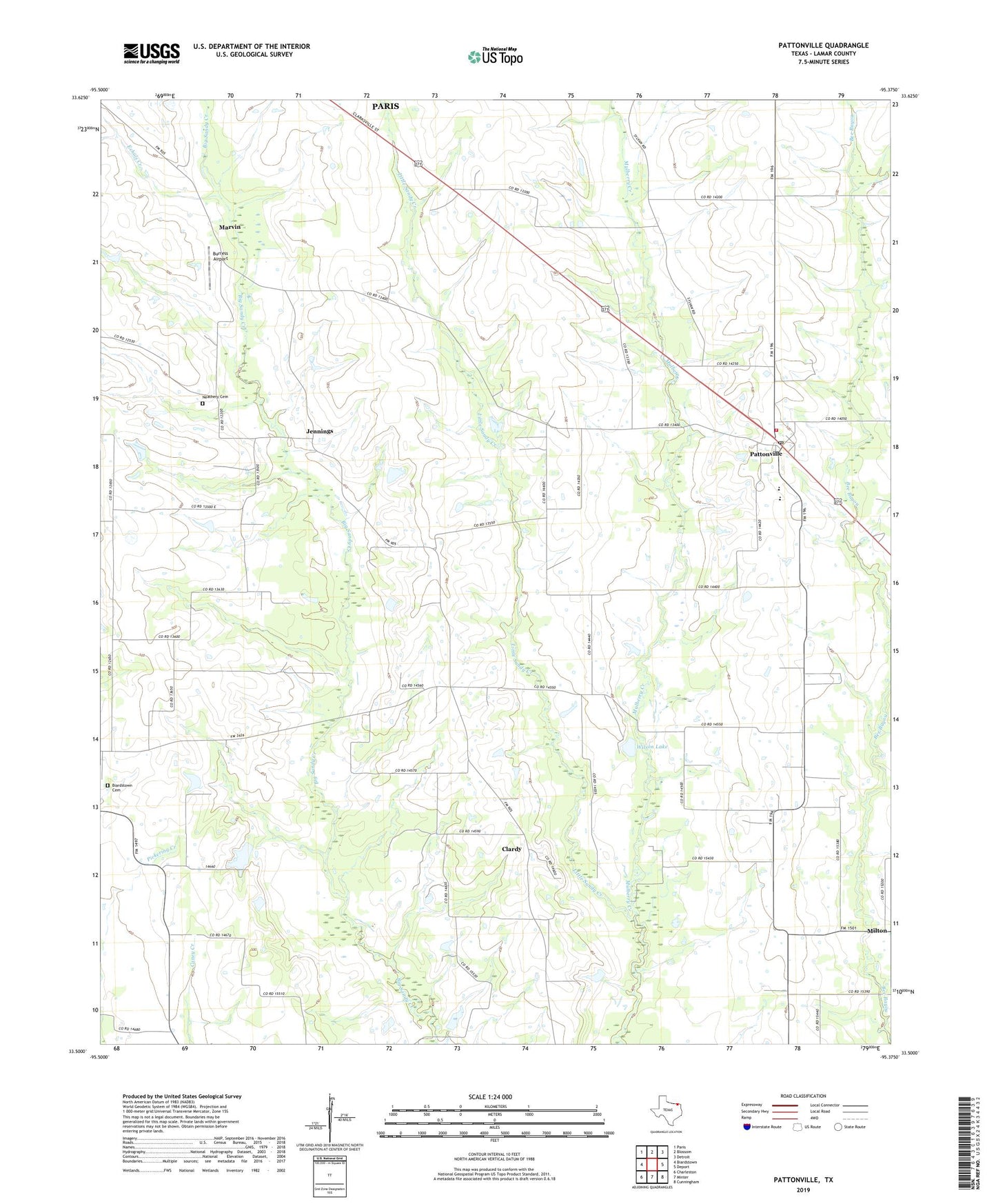
2019 topographic map quadrangle Pattonville in the state of Texas. Scale: 1:24000. Based on the newly updated USGS 7.5' US Topo map series, this map is in the following counties: Lamar. The map contains contour data, water features, and other items you are used to seeing on USGS maps, but also has updated roads and other features. This is the next generation of topographic maps. Printed on high-quality waterproof paper with UV fade-resistant inks.
Quads adjacent to this one:
West: Biardstown
Northwest: Paris
North: Blossom
Northeast: Detroit
East: Deport
Southeast: Cunningham
South: Minter
Southwest: Charleston
Contains the following named places: Bethel Church, Biardstown Cemetery, Burress Airport, Clardy, Deport Division, East Lamar High School, Echols Creek, Jennings, Marvin, Mulberry Creek, Neathery Cemetery, Newman Dam Number 4, Newman Lake Number 4, Pattonville, Pattonville Post Office, Pattonville Volunteer Fire Department, Plainview Community Hall, Shady Grove Church, Wilson Lake, Wilson Lake Dam, ZIP Codes: 75462, 75468