MyTopo
Cunningham Texas US Topo Map
Couldn't load pickup availability
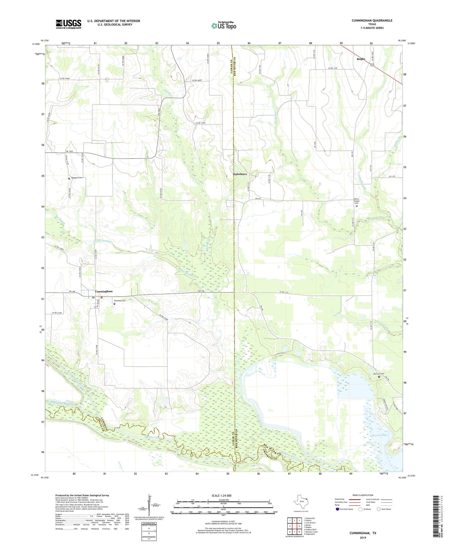
2022 topographic map quadrangle Cunningham in the state of Texas. Scale: 1:24000. Based on the newly updated USGS 7.5' US Topo map series, this map is in the following counties: Red River, Lamar, Delta, Franklin, Hopkins. The map contains contour data, water features, and other items you are used to seeing on USGS maps, but also has updated roads and other features. This is the next generation of topographic maps. Printed on high-quality waterproof paper with UV fade-resistant inks.
Quads adjacent to this one:
West: Minter
Northwest: Pattonville
North: Deport
Northeast: Line Branch
East: Bogata
Southeast: Hagansport
South: Mitchell Creek
Southwest: Sulphur Bluff
This map covers the same area as the classic USGS quad with code o33095d3.
Contains the following named places: Bee Bayou, Brushy Creek, Cunningham, Cunningham Post Office, Cunningham Volunteer Fire Department, Dawson Lake, Halesboro, Lake Drain Branch, Little Sandy Creek, Lone Oak, McCrury Cemetery, Morris Chapel Cemetery, North Sulphur River, Restland Cemetery, Rugby, South Sulphur River, Webber Branch, West Brushy Creek, Woodard Cemetery, ZIP Code: 75435