MyTopo
Perico Texas US Topo Map
Couldn't load pickup availability
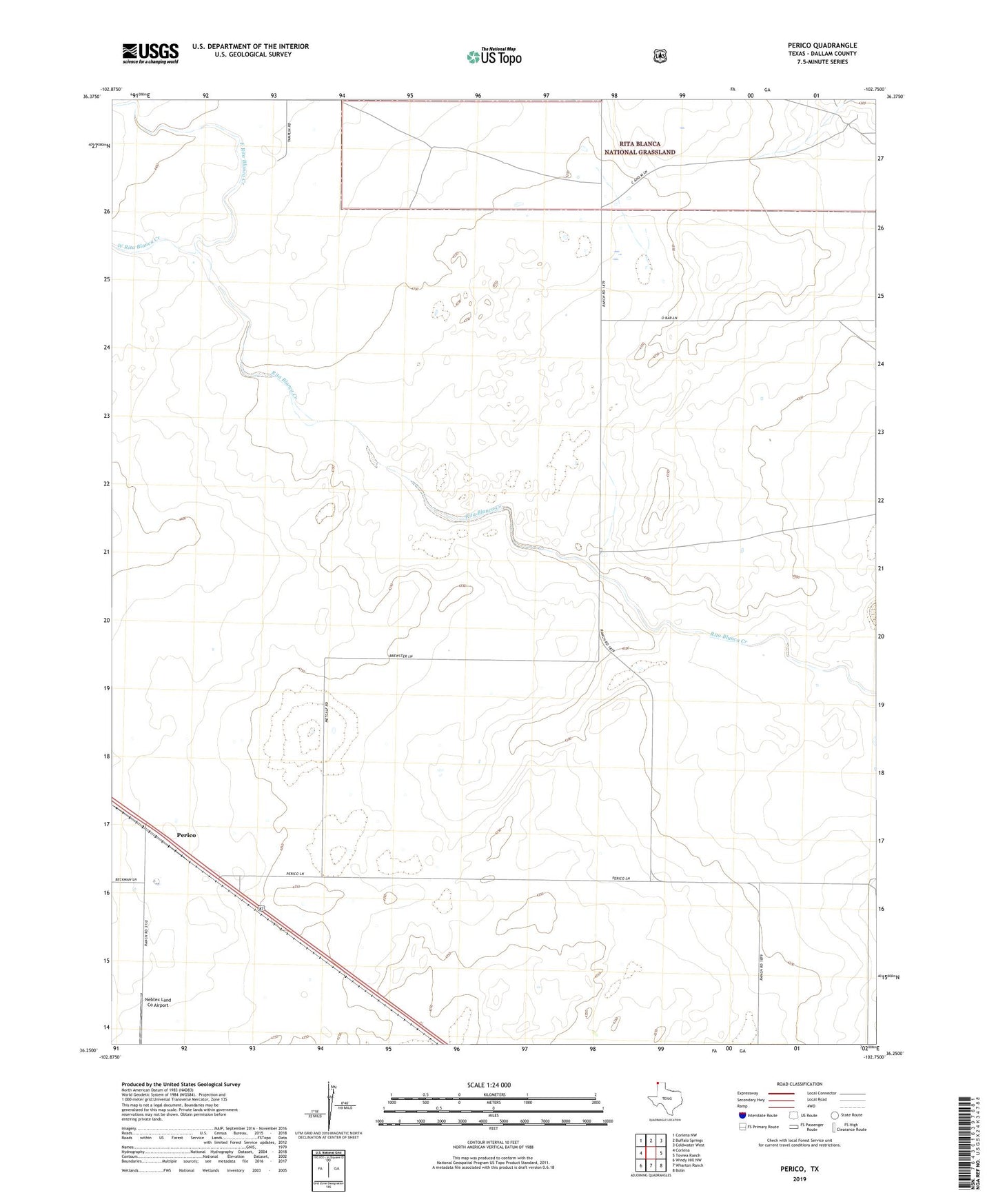
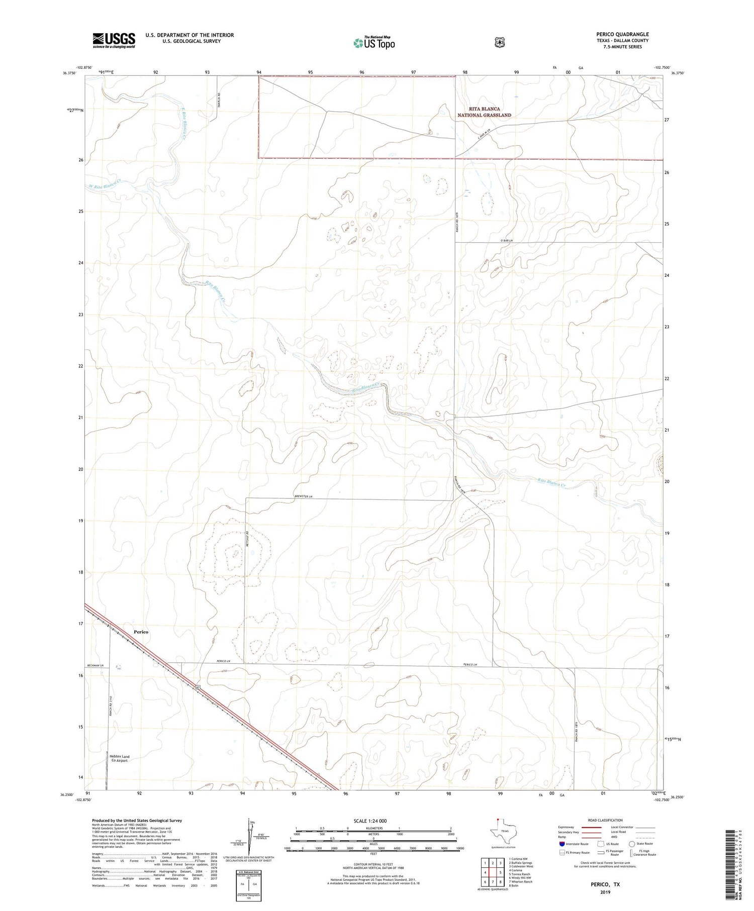
2019 topographic map quadrangle Perico in the state of Texas. Scale: 1:24000. Based on the newly updated USGS 7.5' US Topo map series, this map is in the following counties: Dallam. The map contains contour data, water features, and other items you are used to seeing on USGS maps, but also has updated roads and other features. This is the next generation of topographic maps. Printed on high-quality waterproof paper with UV fade-resistant inks.
Quads adjacent to this one:
West: Corlena
Northwest: Corlena NW
North: Buffalo Springs
Northeast: Coldwater West
East: Tovrea Ranch
Southeast: Bolin
South: Wharton Ranch
Southwest: Windy Hill NW
Contains the following named places: East Rita Blanca Creek, Nebtex Land Co Airport, Perico, West Rita Blanca Creek