MyTopo
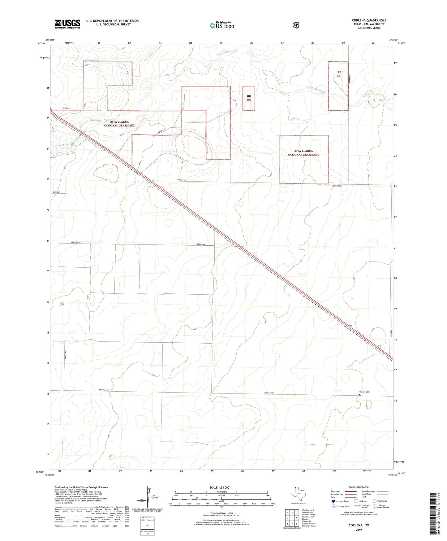
Corlena Texas US Topo Map
Couldn't load pickup availability
Also explore the Corlena Forest Service Topo of this same quad for updated USFS data
2022 topographic map quadrangle Corlena in the state of Texas. Scale: 1:24000. Based on the newly updated USGS 7.5' US Topo map series, this map is in the following counties: Dallam. The map contains contour data, water features, and other items you are used to seeing on USGS maps, but also has updated roads and other features. This is the next generation of topographic maps. Printed on high-quality waterproof paper with UV fade-resistant inks.
Quads adjacent to this one:
North: Corlena NW
Northeast: Buffalo Springs
East: Perico
Southeast: Wharton Ranch
South: Windy Hill NW
Southwest: Sedan NE
This map covers the same area as the classic USGS quad with code o36102c8.
Contains the following named places: Corlena, Perico Cemetery, Saint Marys Church, Texline Division, ZIP Code: 79087