MyTopo
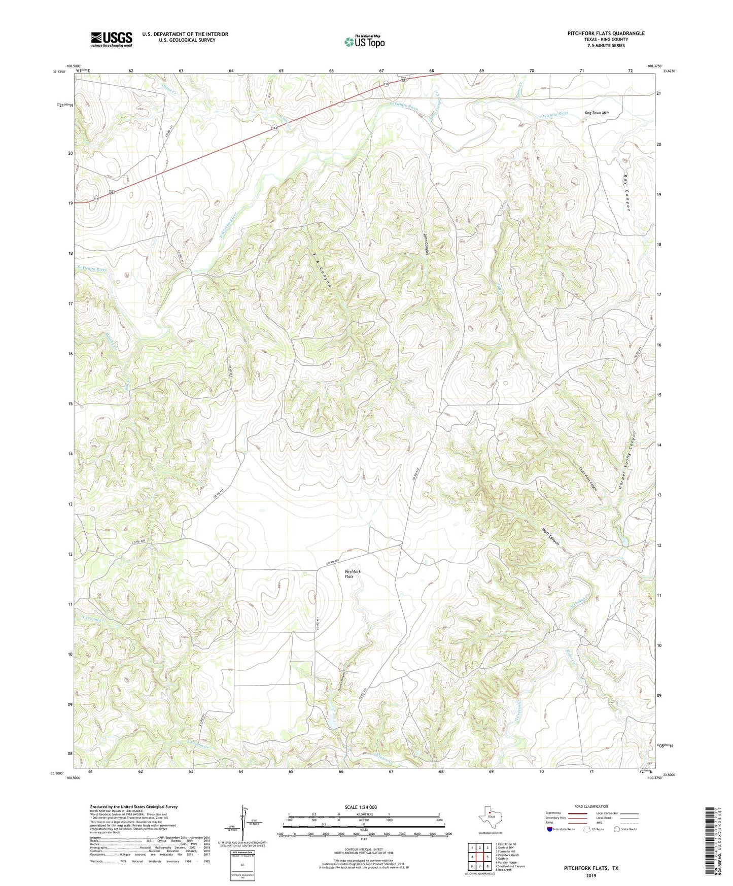
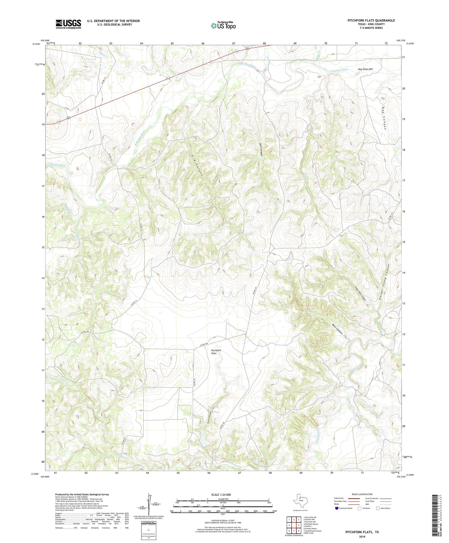
Pitchfork Flats Texas US Topo Map
Couldn't load pickup availability
2019 topographic map quadrangle Pitchfork Flats in the state of Texas. Scale: 1:24000. Based on the newly updated USGS 7.5' US Topo map series, this map is in the following counties: King. The map contains contour data, water features, and other items you are used to seeing on USGS maps, but also has updated roads and other features. This is the next generation of topographic maps. Printed on high-quality waterproof paper with UV fade-resistant inks.
Quads adjacent to this one:
West: Pitchfork Ranch
Northwest: East Afton NE
North: Guthrie NW
Northeast: Fourmile Hill
East: Guthrie
Southeast: Bob Creek
South: Southerland Canyon
Southwest: Pursley House
Contains the following named places: Brushy Creek, Cedar Point Canyon, Chalk Windmill, China Creek, Dog Town Mountain, Dog Town Mountain Windmill, Dugout Windmill, E Vat Windmill, F A Canyon, F A Windmill, Fa Windmill, Graves Hollow, Harper Young Canyon, Hollywood Windmill, Krit Windmill, Long Canyon Creek, Lynn Canyon, Lynn Canyon Windmill, North F A Windmill, Owens Windmill, Pitchfork Flats, Pitchfork Flats Windmill, Ratliff Pen Windmill, Ray Canyon, Ray Hollow Windmill, Rider Creek, Saline Creek, Salt Creek, Texas No Name Number 20 Dam, Wall Canyon, Wall Canyon Windmill