MyTopo
Pursley House Texas US Topo Map
Couldn't load pickup availability
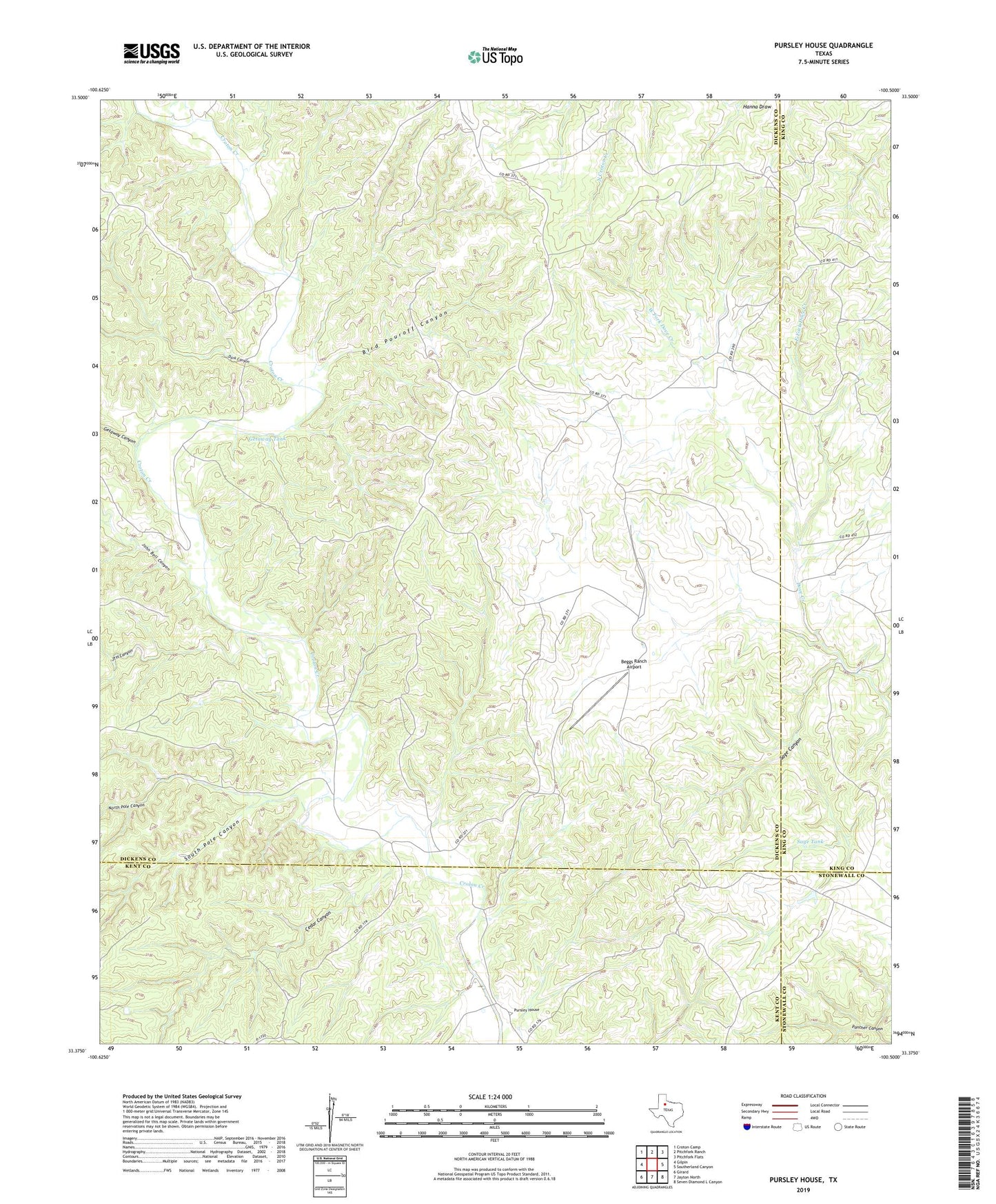
2022 topographic map quadrangle Pursley House in the state of Texas. Scale: 1:24000. Based on the newly updated USGS 7.5' US Topo map series, this map is in the following counties: Dickens, Kent, King, Stonewall. The map contains contour data, water features, and other items you are used to seeing on USGS maps, but also has updated roads and other features. This is the next generation of topographic maps. Printed on high-quality waterproof paper with UV fade-resistant inks.
Quads adjacent to this one:
West: Gilpin
Northwest: Croton Camp
North: Pitchfork Ranch
Northeast: Pitchfork Flats
East: Southerland Canyon
Southeast: Seven Diamond L Canyon
South: Jayton North
Southwest: Girard
This map covers the same area as the classic USGS quad with code o33100d5.
Contains the following named places: Allen Windmill, Bar J G Windmill, Beggs Ranch, Beggs Ranch Airport, Bird Pouroff Canyon, Bird Pouroff Windmill, Cedar Canyon, Dark Canyon, East Fork Dove Creek, Getaway Canyon, Getaway Pens, Getaway Tank, Hill and Hill Wells, John Bell Canyon, JTH Canyon, Keller Field Camp, North Pole Canyon, North Windmill, Pursley House, Sage Canyon, Sage Tank, Salt Windmill, South Pole Canyon, Sullivan Windmill, Twin Wells, West Fork Dove Creek, White Face Windmill