MyTopo
Pitchfork Ranch Texas US Topo Map
Couldn't load pickup availability
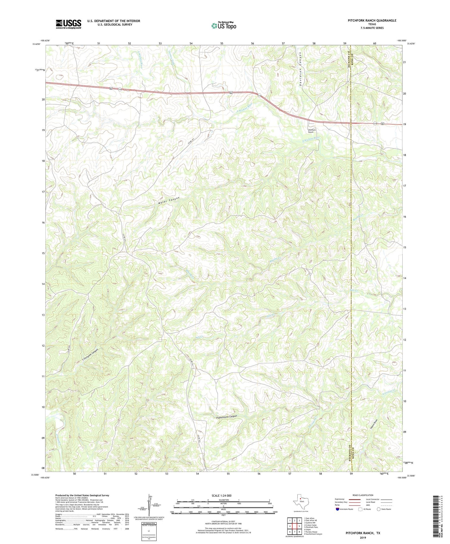
2019 topographic map quadrangle Pitchfork Ranch in the state of Texas. Scale: 1:24000. Based on the newly updated USGS 7.5' US Topo map series, this map is in the following counties: Dickens, King. The map contains contour data, water features, and other items you are used to seeing on USGS maps, but also has updated roads and other features. This is the next generation of topographic maps. Printed on high-quality waterproof paper with UV fade-resistant inks.
Quads adjacent to this one:
West: Croton Camp
Northwest: East Afton
North: East Afton NE
Northeast: Guthrie NW
East: Pitchfork Flats
Southeast: Southerland Canyon
South: Pursley House
Southwest: Gilpin
Contains the following named places: Corner Windmill, Croton Windmill, Davidson Canyon, Devils Playground Windmill, Double Tubs Windmill, East Presley Windmill, Farm Windmill, Flakemoore Canyon, Flakemoore Windmill, Fortyone Windmill, Geneva Fork, Goat Windmill, Hanna Draw, Hanna Windmill, Humble Windmill, James Hodge Windmill, Matador Windmill, North Brushy Windmill, Orchard Windmill, Pitchfork Ranch, Salt Creek Windmill, South Brushy Windmill, South Davidson Windmill, Water Canyon, Water Canyon Windmill, West Devils Playground Windmill, West Presley Windmill, West Vat Windmill