MyTopo
Rayland Texas US Topo Map
Couldn't load pickup availability
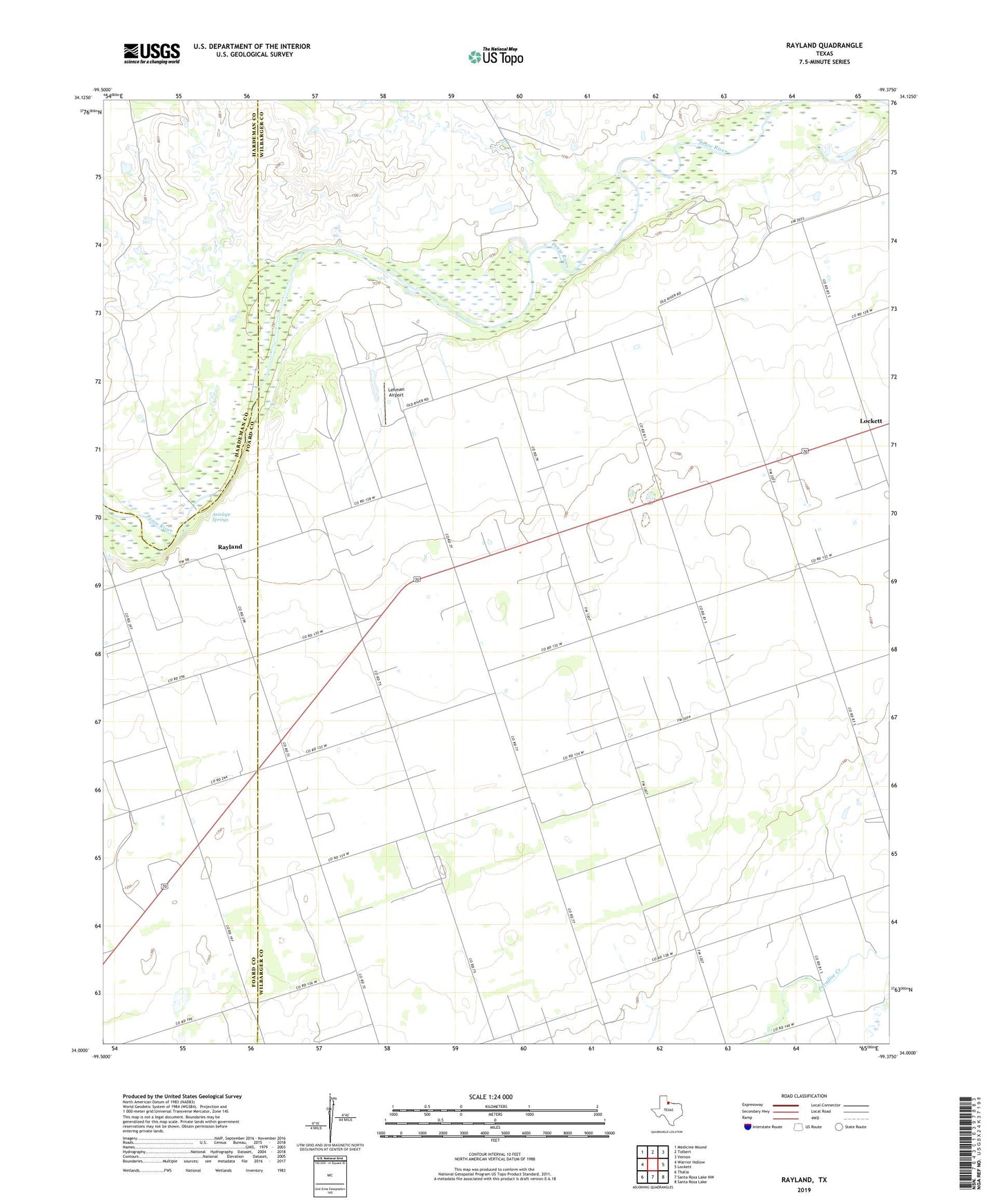
2019 topographic map quadrangle Rayland in the state of Texas. Scale: 1:24000. Based on the newly updated USGS 7.5' US Topo map series, this map is in the following counties: Wilbarger, Foard, Hardeman. The map contains contour data, water features, and other items you are used to seeing on USGS maps, but also has updated roads and other features. This is the next generation of topographic maps. Printed on high-quality waterproof paper with UV fade-resistant inks.
Quads adjacent to this one:
West: Warrior Hollow
Northwest: Medicine Mound
North: Tolbert
Northeast: Vernon
East: Lockett
Southeast: Santa Rosa Lake
South: Santa Rosa Lake NW
Southwest: Thalia
Contains the following named places: Antelope Springs, Lehman Airport, Lockett, Lockett High School, Parsley Hill, Pleasant Home Church, Rayland, Zion Church