MyTopo
Warrior Hollow Texas US Topo Map
Couldn't load pickup availability
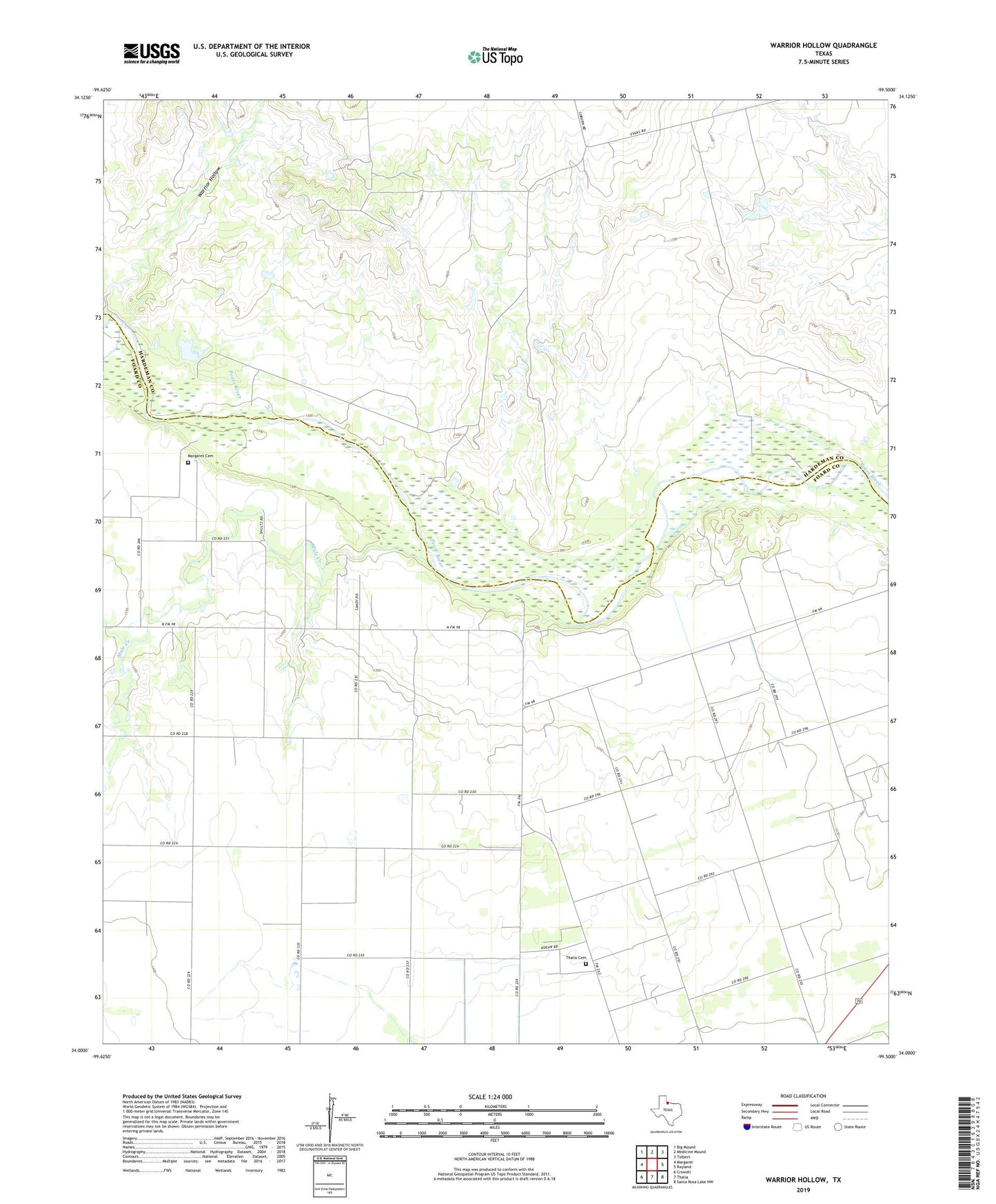
2022 topographic map quadrangle Warrior Hollow in the state of Texas. Scale: 1:24000. Based on the newly updated USGS 7.5' US Topo map series, this map is in the following counties: Foard, Hardeman. The map contains contour data, water features, and other items you are used to seeing on USGS maps, but also has updated roads and other features. This is the next generation of topographic maps. Printed on high-quality waterproof paper with UV fade-resistant inks.
Quads adjacent to this one:
West: Margaret
Northwest: Big Mound
North: Medicine Mound
Northeast: Tolbert
East: Rayland
Southeast: Santa Rosa Lake NW
South: Thalia
Southwest: Crowell
This map covers the same area as the classic USGS quad with code o34099a5.
Contains the following named places: Crowell Water Supply, Historical Marker, Margaret Cemetery, Mule Creek, Pease River Battlefield, Thalia Cemetery, Warrior Hollow