MyTopo
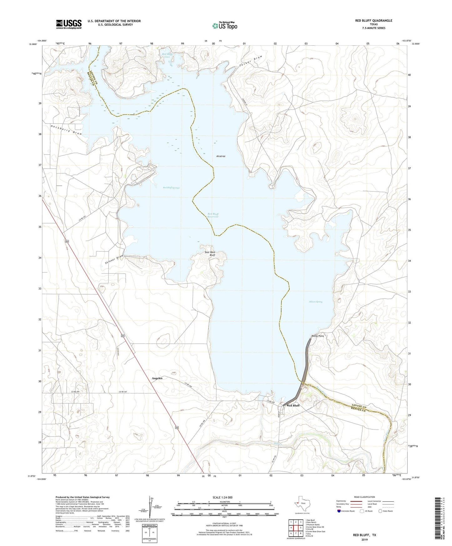
Red Bluff Texas US Topo Map
Couldn't load pickup availability
2019 topographic map quadrangle Red Bluff in the state of Texas. Scale: 1:24000. Based on the newly updated USGS 7.5' US Topo map series, this map is in the following counties: Reeves, Loving. The map contains contour data, water features, and other items you are used to seeing on USGS maps, but also has updated roads and other features. This is the next generation of topographic maps. Printed on high-quality waterproof paper with UV fade-resistant inks.
Quads adjacent to this one:
West: Screw Bean Draw NE
Northwest: Red Bluff
North: Ross Ranch
Northeast: Phantom Banks
East: Orla NE
Southeast: Orla SE
South: Orla
Southwest: Screw Bean Draw East
Contains the following named places: Alcatraz, Allison Spring, Angeles, East West Bluff, Hackberry Draw, Red Bluff, Red Bluff Cove, Red Bluff Dam, Red Bluff Reservoir, Red Bluff Springs, Robinson Arms Landing, Rocky Point, Salt Creek, Skinner Draw, Sullivan Oil Field, Tucker Draw, ZIP Code: 79770