MyTopo
Red Bluff New Mexico US Topo Map
Couldn't load pickup availability
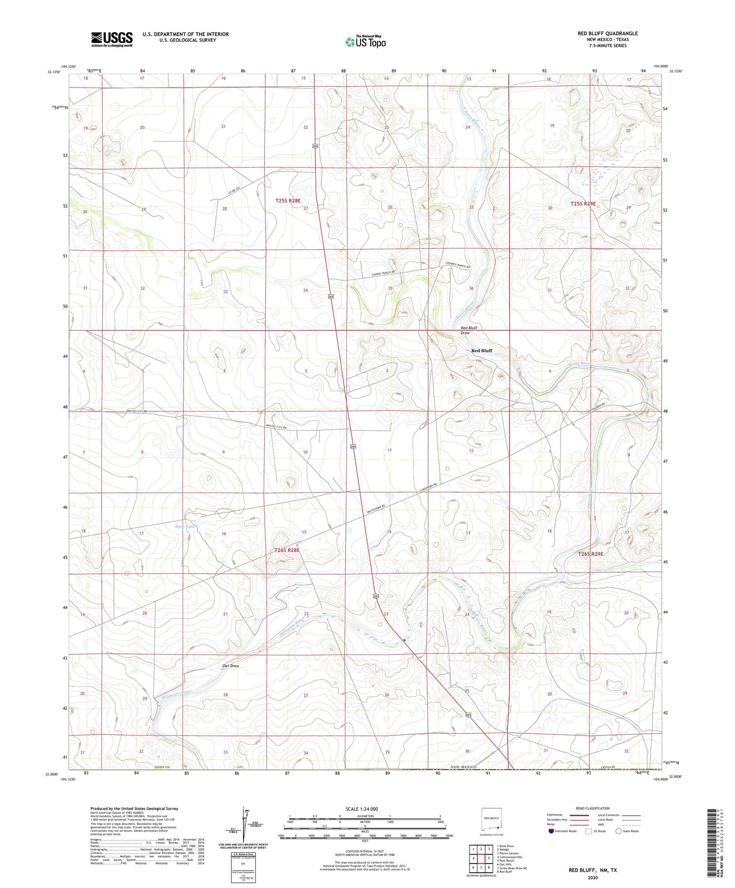
2023 topographic map quadrangle Red Bluff in the state of New Mexico. Scale: 1:24000. Based on the newly updated USGS 7.5' US Topo map series, this map is in the following counties: Eddy, Reeves, Culberson. The map contains contour data, water features, and other items you are used to seeing on USGS maps, but also has updated roads and other features. This is the next generation of topographic maps. Printed on high-quality waterproof paper with UV fade-resistant inks.
Quads adjacent to this one:
West: Cottonwood Hills
Northwest: Bond Draw
North: Malaga
Northeast: Pierce Canyon
East: Ross Ranch
Southeast: Red Bluff
South: Screw Bean Draw NE
Southwest: Owl Hills
This map covers the same area as the classic USGS quad with code o32104a1.
Contains the following named places: 05121 Water Well, 06633 Water Well, 06634 Water Well, 08033 Water Well, 08035 Water Well, 20081 Water Well, 20082 Water Well, 20093 Water Well, 20094 Water Well, 88263, Coad Tank, Corral, Delaware Ranch, Delaware River, East Apple Tank, Mule Tank, Owl Draw, Queen Ranch, Queen Well, Red Bluff, Red Bluff Draw, Rock House, Rock House Crossing, Rustler Breaks, Yarbro Well