MyTopo
Roosevelt Texas US Topo Map
Couldn't load pickup availability
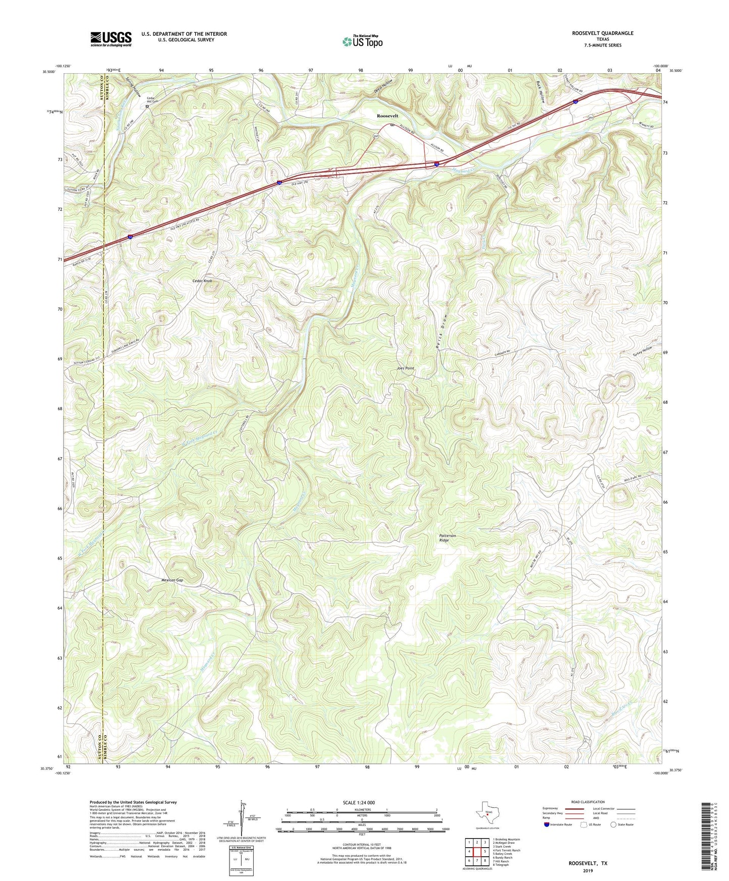
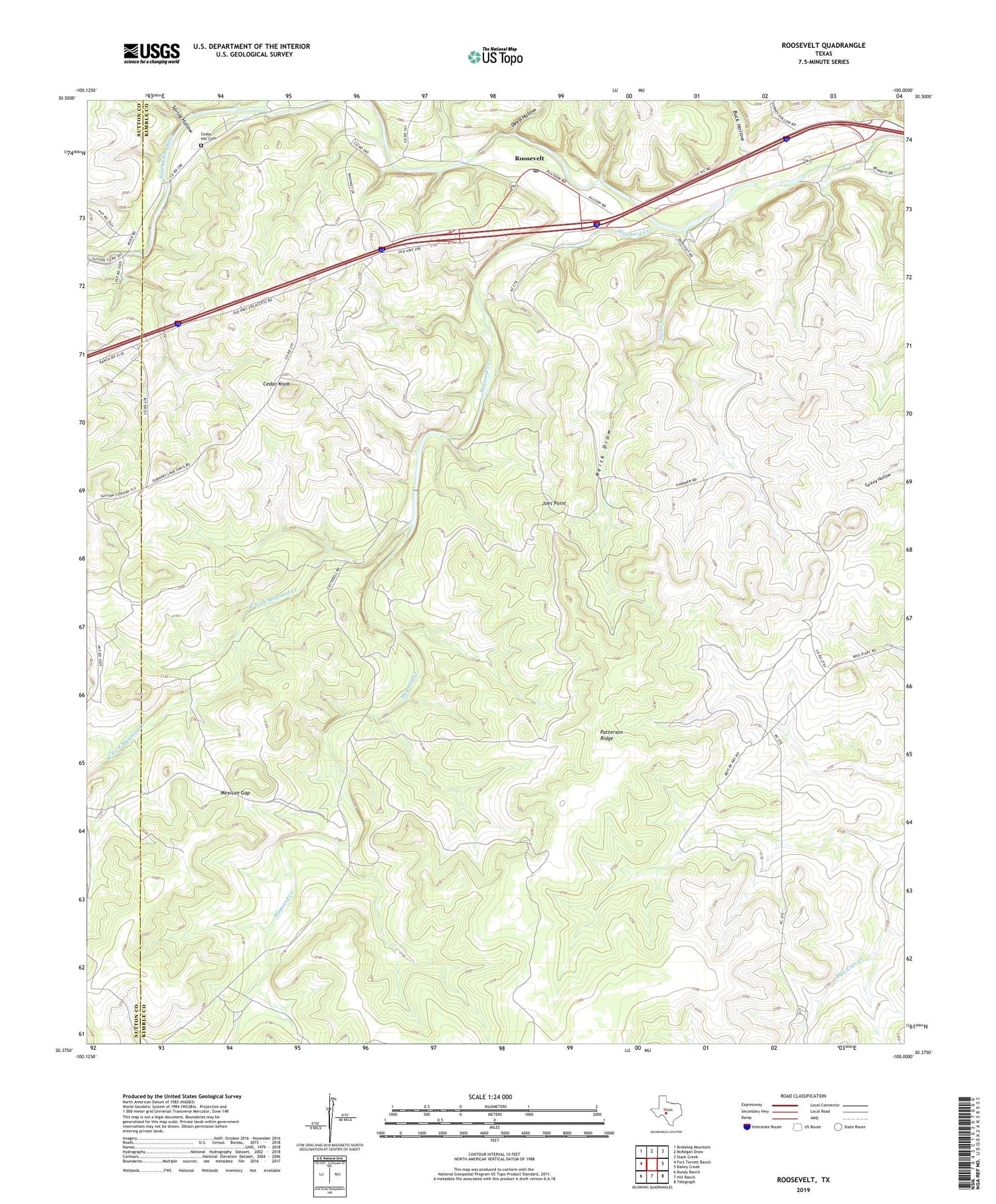
2019 topographic map quadrangle Roosevelt in the state of Texas. Scale: 1:24000. Based on the newly updated USGS 7.5' US Topo map series, this map is in the following counties: Kimble, Sutton. The map contains contour data, water features, and other items you are used to seeing on USGS maps, but also has updated roads and other features. This is the next generation of topographic maps. Printed on high-quality waterproof paper with UV fade-resistant inks.
Quads adjacent to this one:
West: Fort Terrett Ranch
Northwest: Brokeleg Mountain
North: McKegan Draw
Northeast: Stark Creek
East: Bailey Creek
Southeast: Telegraph
South: Hill Ranch
Southwest: Bundy Ranch
Contains the following named places: Buck Hollow, Cedar Hill Cemetery, Cedar Knob, Deep Hollow, Frog Creek, Holland Ranch, Joes Point, Mansfield Ranch, Maynard Creek, Maynard Ranch, Mexican Gap, Patterson Ridge, Reick Draw, Roosevelt, Roosevelt Post Office, Spring Hollow, West Fork Maynard Creek, Wilson Place, ZIP Code: 76874