MyTopo
Fort Terrett Ranch Texas US Topo Map
Couldn't load pickup availability
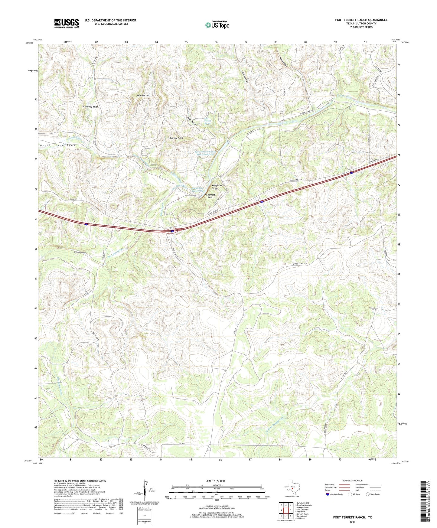
2022 topographic map quadrangle Fort Terrett Ranch in the state of Texas. Scale: 1:24000. Based on the newly updated USGS 7.5' US Topo map series, this map is in the following counties: Sutton. The map contains contour data, water features, and other items you are used to seeing on USGS maps, but also has updated roads and other features. This is the next generation of topographic maps. Printed on high-quality waterproof paper with UV fade-resistant inks.
Quads adjacent to this one:
West: Live Oak Draw
Northwest: Buffalo Well SE
North: Brokeleg Mountain
Northeast: McKegan Draw
East: Roosevelt
Southeast: Hill Ranch
South: Bundy Ranch
Southwest: Stewart Ranch
This map covers the same area as the classic USGS quad with code o30100d2.
Contains the following named places: Anderson Ranch, Bell Hollow, Bull Well, Burton Ranch, Camp Allison, Cat Hollow, Cedar Hill Church, Chimney Bluff, Dry Llano River, Dummy Point, Eightmile Draw, Fort Terrett Peak, Fort Terrett Ranch Historical Site, Fort Terrett Ranch River Dam, Fort Terrett Ranch River Reservoir, Fort Terrett Spring, Foster Ranch, Kingfisher Bluff, Kingfisher Waterhole, McCarty Creek, Mule Hollow, North Llano Draw, Rieck Ranch, Twin Buttes