MyTopo
Sadler Texas US Topo Map
Couldn't load pickup availability
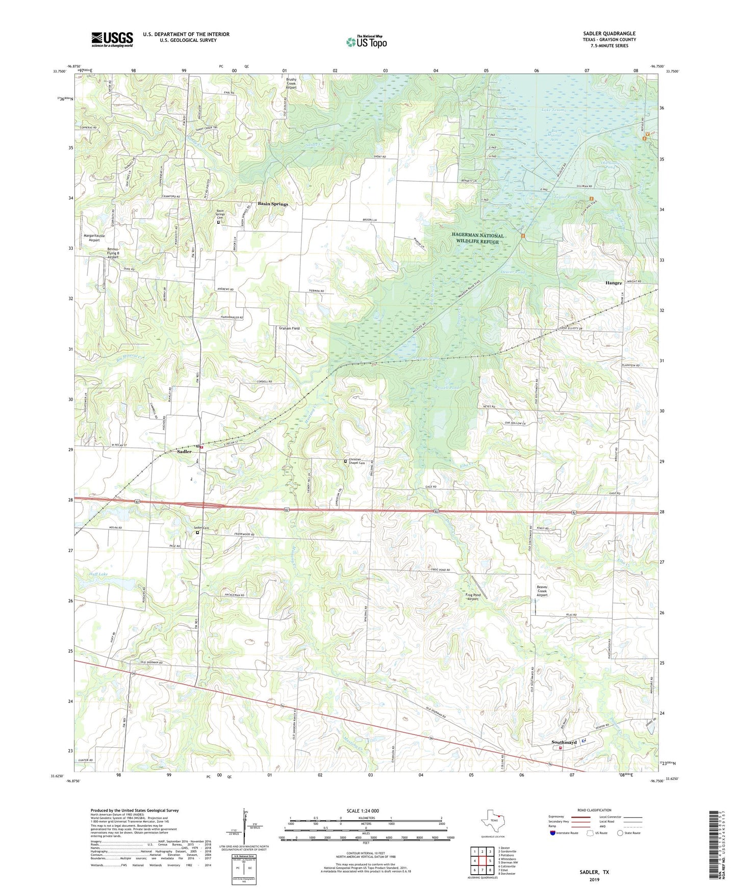
2019 topographic map quadrangle Sadler in the state of Texas. Scale: 1:24000. Based on the newly updated USGS 7.5' US Topo map series, this map is in the following counties: Grayson. The map contains contour data, water features, and other items you are used to seeing on USGS maps, but also has updated roads and other features. This is the next generation of topographic maps. Printed on high-quality waterproof paper with UV fade-resistant inks.
Quads adjacent to this one:
West: Whitesboro
Northwest: Dexter
North: Gordonville
Northeast: Pottsboro
East: Sherman NW
Southeast: Dorchester
South: Ethel
Southwest: Collinsville
Contains the following named places: Basin Springs, Basin Springs Cemetery, Beaver Creek Airport, Bevoni-Flying B Airport, Big Mineral Creek, Big Mineral Public Use Area, Christian Chapel Cemetery, City of Sadler, Deaver Creek, Deaver Pond, Elba Creek, Elm Pond, Frog Pond Airport, Gage, Graham Field, Hagerman National Wildlife Refuge, Hanger, Harris Creek, Hudgins Oil Field, Huff Lake, J P Huff Dam, Kendall Chapel, Kendall Chapel Cemetery, KTCY-FM (Denison), Margaritaville Airport, Martin Branch, Mayd, Meadow Pond, Meadow Pond Trail, Mulder Oil Field, Mustang Creek, Old Goose Pond, Russell Pond, Saddler Oil Field, Sadler, Sadler Cemetery, Sadler City Hall, Sadler Post Office, Sadler Volunteer Fire Department, Sadler-Moulder Mineral Oil Field, Southmayd, Southmayd City Hall, Southmayd Police Department, Southmayd Volunteer Fire Department, Steedham, Taylor Pond, Thorne, ZIP Codes: 76264, 76268