MyTopo
Dorchester Texas US Topo Map
Couldn't load pickup availability
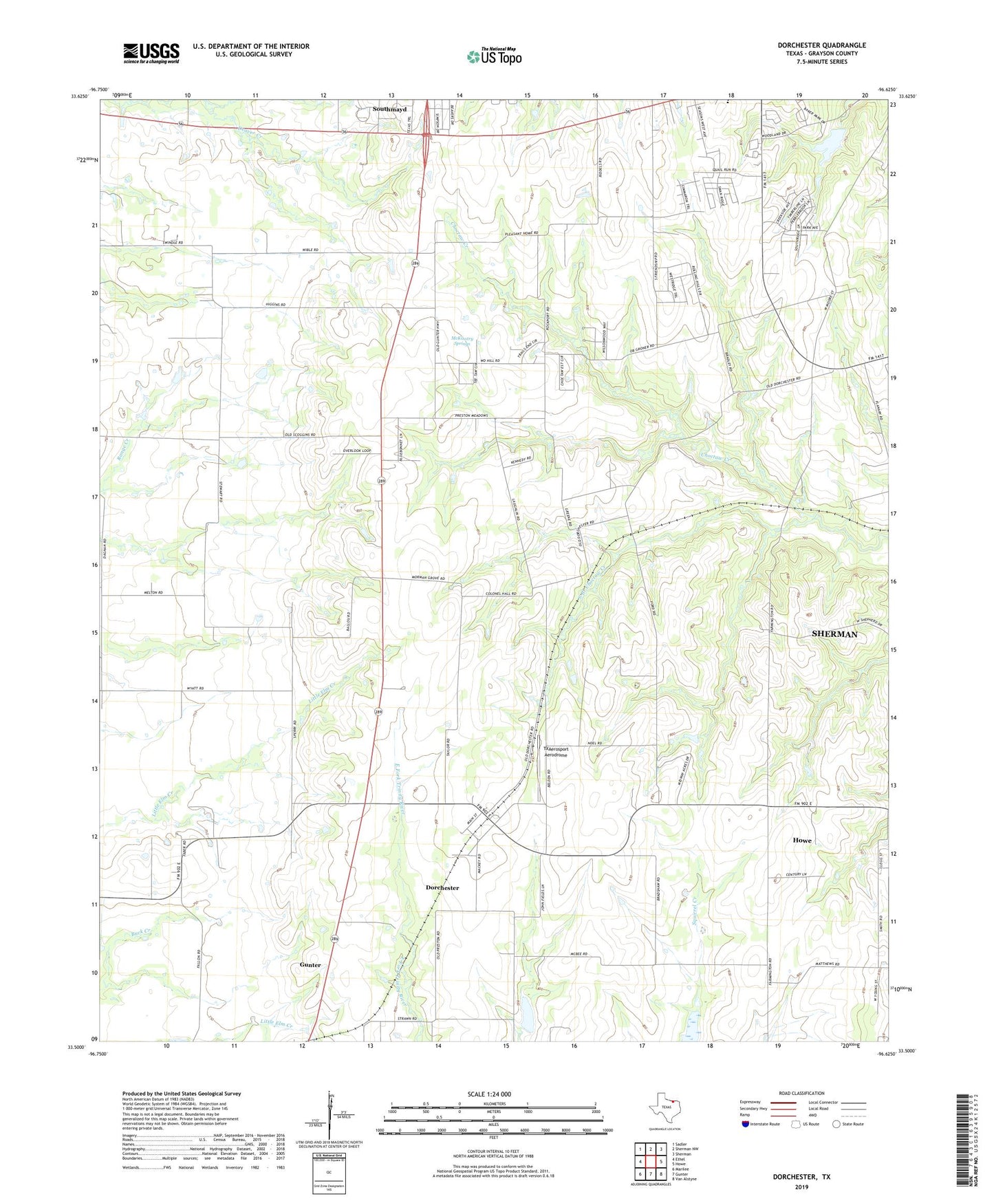
2022 topographic map quadrangle Dorchester in the state of Texas. Scale: 1:24000. Based on the newly updated USGS 7.5' US Topo map series, this map is in the following counties: Grayson. The map contains contour data, water features, and other items you are used to seeing on USGS maps, but also has updated roads and other features. This is the next generation of topographic maps. Printed on high-quality waterproof paper with UV fade-resistant inks.
Quads adjacent to this one:
West: Ethel
Northwest: Sadler
North: Sherman NW
Northeast: Sherman
East: Howe
Southeast: Van Alstyne
South: Gunter
Southwest: Marilee
This map covers the same area as the classic USGS quad with code o33096e6.
Contains the following named places: Church of God, City of Dorchester, City of Southmayd, Dorchester, Dorchester City Hall, Herman Baker Park Trail, McKinstry Springs, Mormon Grove, Mormon Grove Cemetery, Mormon Grove Post Office, Soil Conservation Service Site 10a Dam, Soil Conservation Service Site 10a Reservoir, Soil Conservation Service Site 18 Dam, Soil Conservation Service Site 18 Reservoir, South Branch Choctaw Creek, Sperry, TXAerosport Aerodrome, ZIP Code: 75459