MyTopo
Saint Hedwig Texas US Topo Map
Couldn't load pickup availability
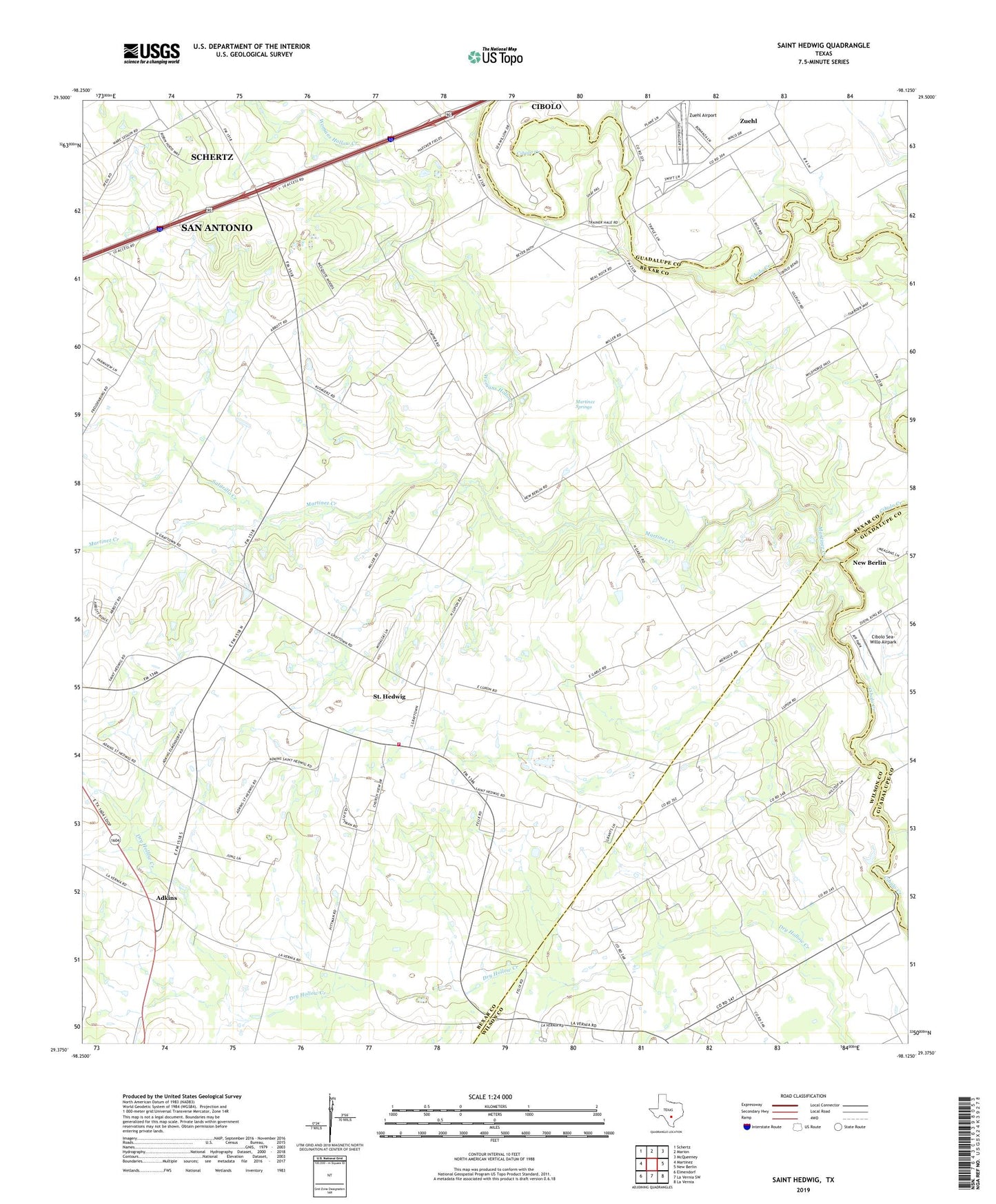
2019 topographic map quadrangle Saint Hedwig in the state of Texas. Scale: 1:24000. Based on the newly updated USGS 7.5' US Topo map series, this map is in the following counties: Bexar, Wilson, Guadalupe. The map contains contour data, water features, and other items you are used to seeing on USGS maps, but also has updated roads and other features. This is the next generation of topographic maps. Printed on high-quality waterproof paper with UV fade-resistant inks.
Quads adjacent to this one:
West: Martinez
Northwest: Schertz
North: Marion
Northeast: McQueeney
East: New Berlin
Southeast: La Vernia
South: La Vernia SW
Southwest: Elmendorf
Contains the following named places: Adkins, Annunication School, Bexar, Burnet County Library System, Carpenter, Cibolo Sea-Willo Airpark, Clemens School, Friendly Corner, Goebel School, Goodwill Church, Hebron Church, Herman Brown Free Library, Idle Airpark, Martinez Creek, Martinez Springs, Midway School, Nighthawk's Nest Airport, Oakalla Public Library, Redeemer Church, Saint Hedwig, Saint Hedwig Post Office, Saint Hedwig Volunteer Fire Department, Salitrillo Creek, Santa Clara Creek, Sculls Crossing, Town of Saint Hedwig, Womans Hollow Creek, Zuehl, Zuehl Airport, Zuehl Census Designated Place, ZIP Code: 78152