MyTopo
San Augustine West Texas US Topo Map
Couldn't load pickup availability
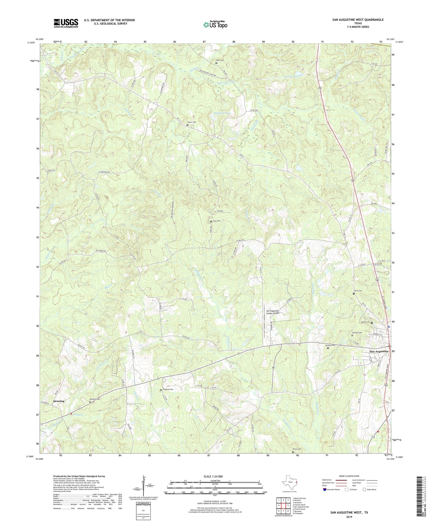
2019 topographic map quadrangle San Augustine West in the state of Texas. Scale: 1:24000. Based on the newly updated USGS 7.5' US Topo map series, this map is in the following counties: San Augustine, Shelby. The map contains contour data, water features, and other items you are used to seeing on USGS maps, but also has updated roads and other features. This is the next generation of topographic maps. Printed on high-quality waterproof paper with UV fade-resistant inks.
Quads adjacent to this one:
West: Chireno North
Northwest: Mount Herman
North: Neuville
Northeast: Hurstown
East: San Augustine East
Southeast: Chinquapin
South: Norwood
Southwest: Chireno South
Contains the following named places: Blount Park, Captain Thomas William Blount House, Cattail Pond, China Chapel Church, Clay Cemetery, Couller Creek, Denning, Denning New Hope Volunteer Fire Department, Garrett Cemetery, Greer Cemetery, Harmony, Heavenly Jerusalem First Born Church, Highland Pond, Holt Cemetery, Ironosa, Lanetown Church, Lewis Cemetery, McKeever Creek, McRae Church, Moses Cemetery, Odell Creek, Perkins Cemetery, Pleasant Hill Church, Price Cemetery, Redland, Rivers Creek, Rocky Branch, Saint Luke Church, Saint Matthew Church, San Augustine County Airport, San Augustine Division, San Augustine Police Department, Sanders Cemetery, Sandy Creek, Shiloh Church, Texas Forest Service San Augustine Office, Thomas Cemetery, Union, William Garrett Plantation House