MyTopo
San Pablo Ranch Texas US Topo Map
Couldn't load pickup availability
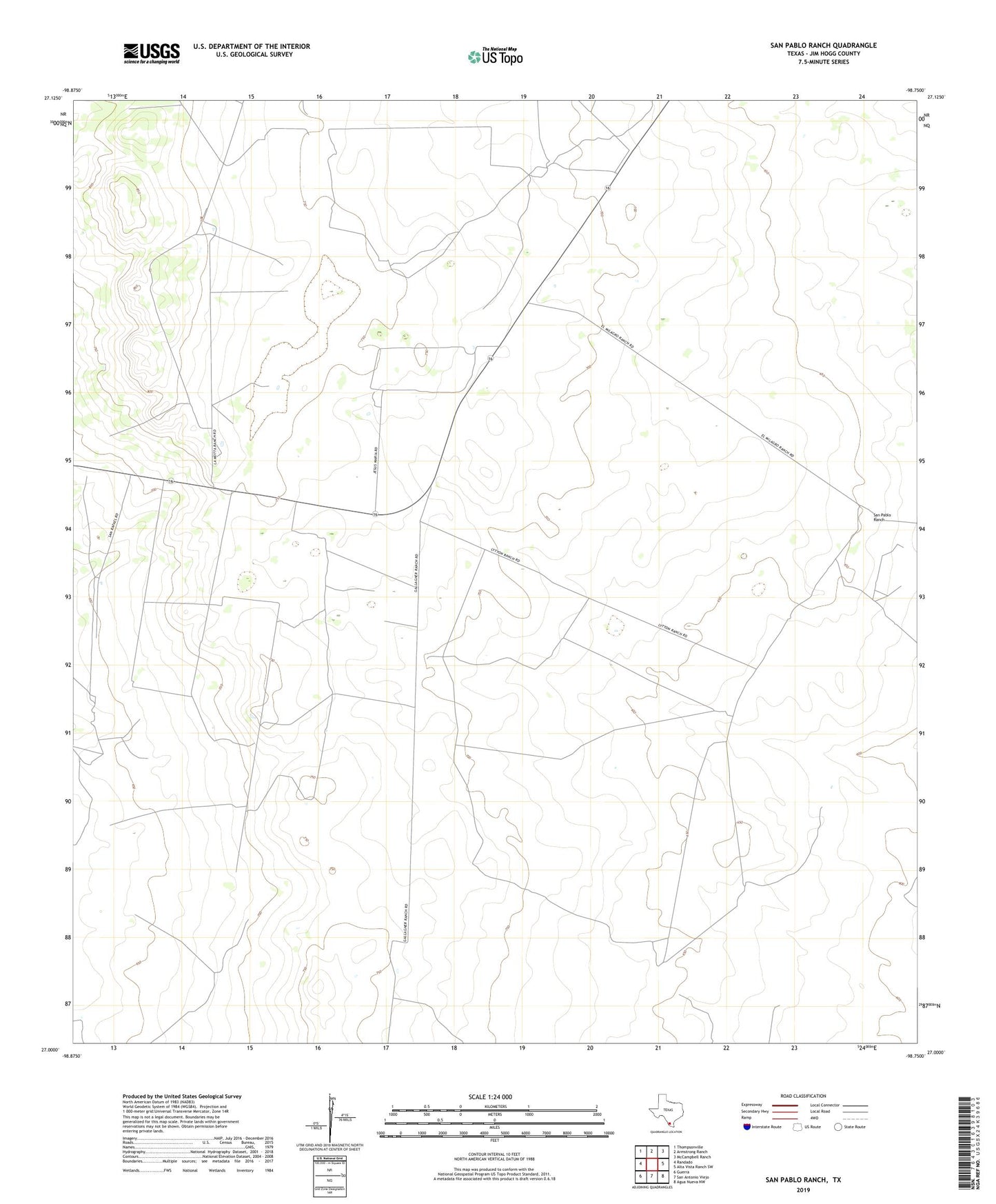
2019 topographic map quadrangle San Pablo Ranch in the state of Texas. Scale: 1:24000. Based on the newly updated USGS 7.5' US Topo map series, this map is in the following counties: Jim Hogg. The map contains contour data, water features, and other items you are used to seeing on USGS maps, but also has updated roads and other features. This is the next generation of topographic maps. Printed on high-quality waterproof paper with UV fade-resistant inks.
Quads adjacent to this one:
West: Randado
Northwest: Thompsonville
North: Armstrong Ranch
Northeast: McCampbell Ranch
East: Alta Vista Ranch SW
Southeast: Agua Nueva NW
South: San Antonio Viejo
Southwest: Guerra
Contains the following named places: Alto Windmill, Colorita Windmill, Gallina Windmill, Granjeno Windmill, Josefina Windmill, Los Negros Windmill, Lova Windmill, Lovon Windmill, Lyton Ranch, Maria Stella Windmill, Pablo Blanco Windmill, Prado Oil Field, Quemado Windmill, Rincon Windmill, Rodeo Windmill, San Juan Windmill, San Pablo Ranch, San Pablo Windmill, San Pedro Windmill, San Rafael Ranch, Sarita Windmill, Sorio Windmill, Tia Nena Windmill, ZIP Code: 78361