MyTopo
San Patricio Texas US Topo Map
Couldn't load pickup availability
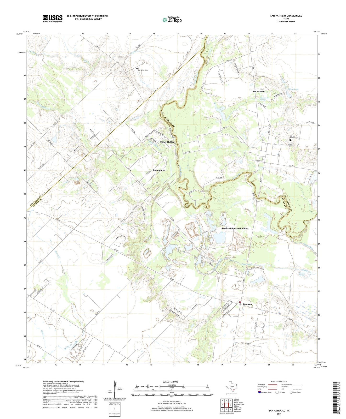
2019 topographic map quadrangle San Patricio in the state of Texas. Scale: 1:24000. Based on the newly updated USGS 7.5' US Topo map series, this map is in the following counties: Nueces, San Patricio, Jim Wells. The map contains contour data, water features, and other items you are used to seeing on USGS maps, but also has updated roads and other features. This is the next generation of topographic maps. Printed on high-quality waterproof paper with UV fade-resistant inks.
Quads adjacent to this one:
West: Orange Grove
Northwest: Sandia
North: Mathis
Northeast: West Sinton
East: Edroy
Southeast: Robstown
South: Banquete
Southwest: Agua Dulce
Contains the following named places: Bluntzer, City of San Patricio, Dismero Springs, Escondidas, Fort Lipantitlan, Glasscock Lake, Glasscock Lake Dam, J A Knolle Airport, J A Knolle Field, James McGloin Homestead, Javelin Creek, Knolle, Lain Creek, Leon Creek, Lilly Lake, Nueces County Emergency Service District 4, Nueces County Emergency Services District 4, Old Ranch Cemetery, Old San Patricio Cemetery, Round Lake, Round Lake Springs, San Patricio, San Patricio City Hall, San Patricio International Airport, Sandy Hollow, Sandy Hollow Creek, Sandy Hollow-Escondidas Census Designated Place, Willow Lake