MyTopo
Edroy Texas US Topo Map
Couldn't load pickup availability
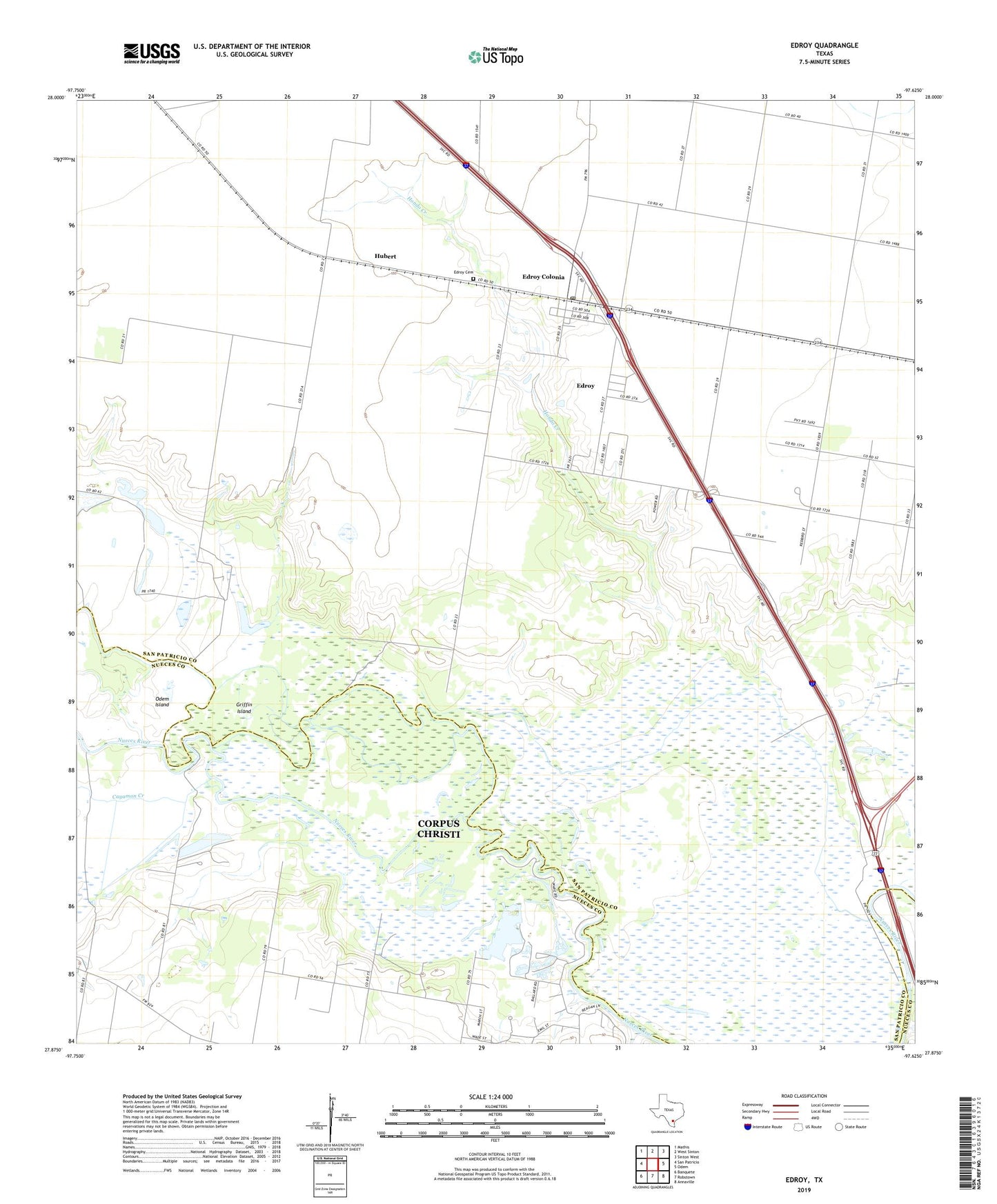
2022 topographic map quadrangle Edroy in the state of Texas. Scale: 1:24000. Based on the newly updated USGS 7.5' US Topo map series, this map is in the following counties: San Patricio, Nueces. The map contains contour data, water features, and other items you are used to seeing on USGS maps, but also has updated roads and other features. This is the next generation of topographic maps. Printed on high-quality waterproof paper with UV fade-resistant inks.
Quads adjacent to this one:
West: San Patricio
Northwest: Mathis
North: West Sinton
Northeast: Sinton West
East: Odem
Southeast: Annaville
South: Robstown
Southwest: Banquete
This map covers the same area as the classic USGS quad with code o27097h6.
Contains the following named places: Calallen Dam, Calallen Reservoir, Calallen Reservoir Dam, Cayamon Creek, Edroy, Edroy Cemetery, Edroy Census Designated Place, Edroy Colonia, Edroy Post Office, Griffin Island, Guadalupe Church, Hilltop Acres Colonia, Hondo Creek, Hubert, Labonte Park, Odem Island, Odem Oil Field, Riverside Oil Field, ZIP Code: 78352