MyTopo
Sanderson Texas US Topo Map
Couldn't load pickup availability
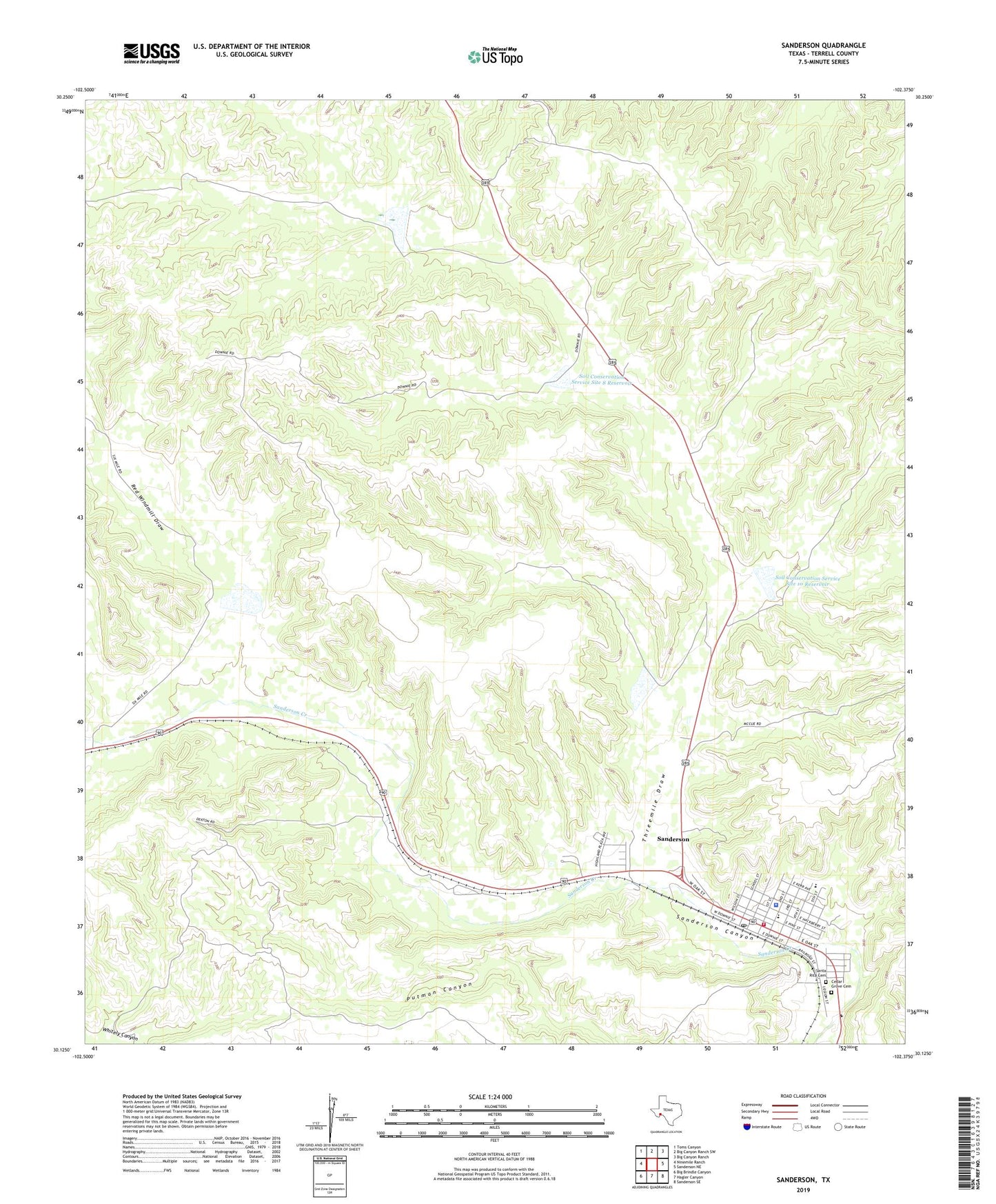
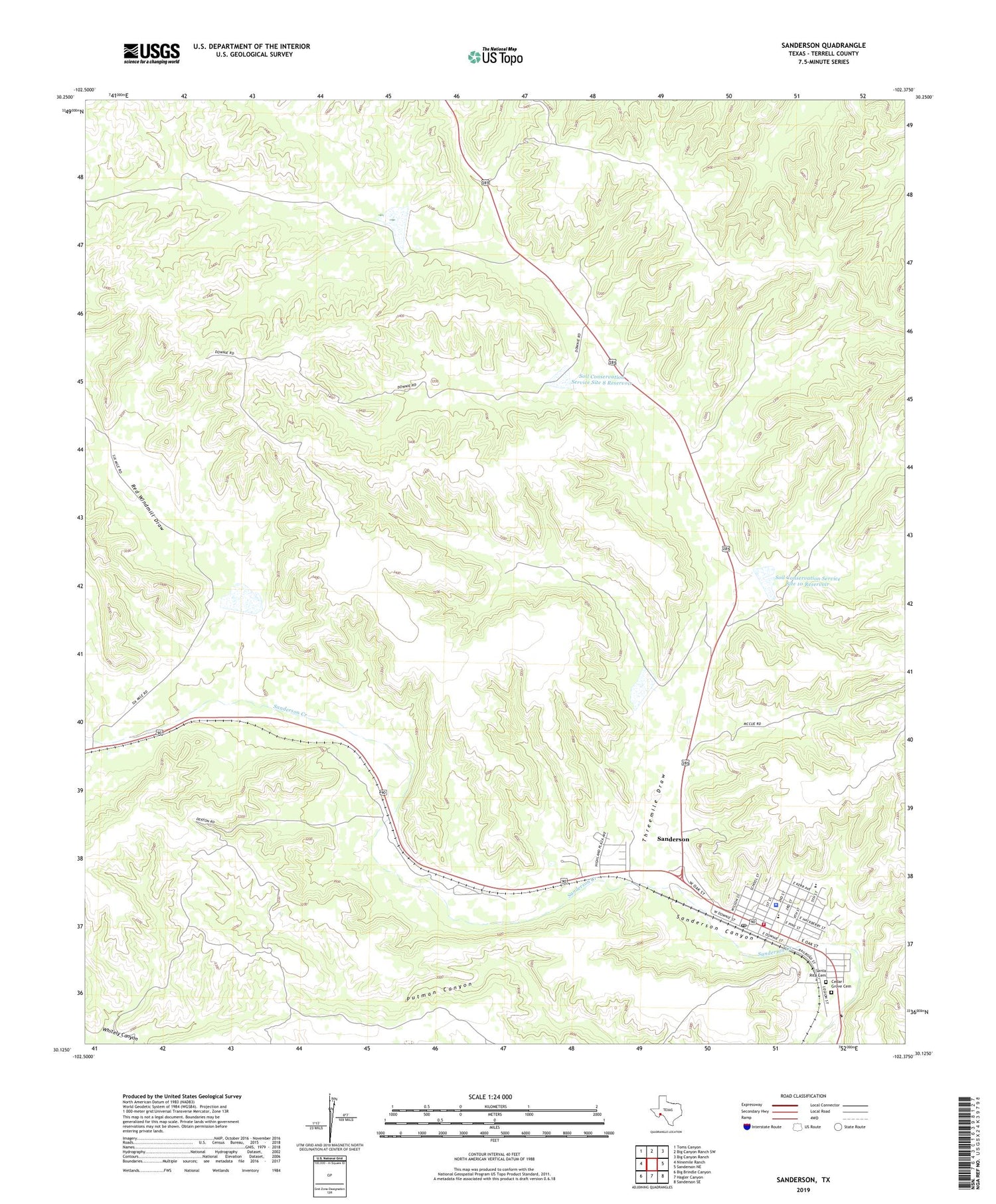
2019 topographic map quadrangle Sanderson in the state of Texas. Scale: 1:24000. Based on the newly updated USGS 7.5' US Topo map series, this map is in the following counties: Terrell. The map contains contour data, water features, and other items you are used to seeing on USGS maps, but also has updated roads and other features. This is the next generation of topographic maps. Printed on high-quality waterproof paper with UV fade-resistant inks.
Quads adjacent to this one:
West: Ninemile Ranch
Northwest: Toms Canyon
North: Big Canyon Ranch SW
Northeast: Big Canyon Ranch
East: Sanderson NE
Southeast: Sanderson SE
South: Hagler Canyon
Southwest: Big Brindle Canyon
Contains the following named places: Cedar Grove Cemetery, Deaf Smith County Library, Deaton Ranch, Downie Ranch, Goldwire Ranch, Red Windmill Draw, Sanderson, Sanderson Census Designated Place, Sanderson Post Office, Santa Rita Cemetery, Soil Conservation Service Site 10 Dam, Soil Conservation Service Site 10 Reservoir, Soil Conservation Service Site 7 Dam, Soil Conservation Service Site 7 Reservoir, Soil Conservation Service Site 8 Dam, Soil Conservation Service Site 8 Reservoir, Soil Conservation Service Site 9 Dam, Soil Conservation Service Site 9 Reservoir, Terrell County Emergency Medical Service, Terrell County Sheriff's Office, Terrell County Volunteer Fire Department, Threemile Draw, United States Border Patrol Station