MyTopo
Silver Texas US Topo Map
Couldn't load pickup availability
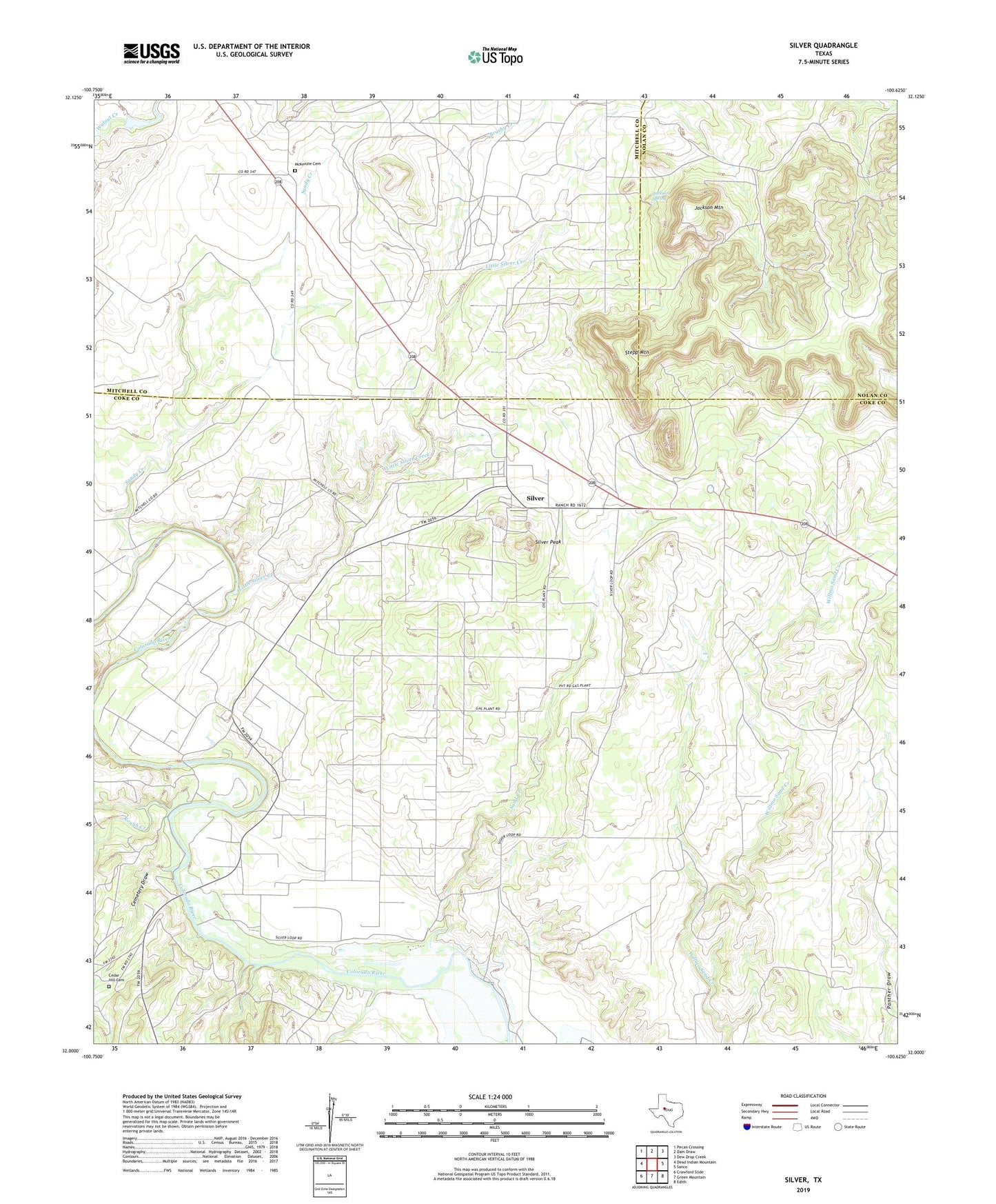
2019 topographic map quadrangle Silver in the state of Texas. Scale: 1:24000. Based on the newly updated USGS 7.5' US Topo map series, this map is in the following counties: Coke, Mitchell, Nolan. The map contains contour data, water features, and other items you are used to seeing on USGS maps, but also has updated roads and other features. This is the next generation of topographic maps. Printed on high-quality waterproof paper with UV fade-resistant inks.
Quads adjacent to this one:
West: Dead Indian Mountain
Northwest: Pecan Crossing
North: Dam Draw
Northeast: Dew Drop Creek
East: Sanco
Southeast: Edith
South: Green Mountain
Southwest: Crawford Slide
Contains the following named places: Brushy Creek, Cedar Hill Cemetery, Cemetery Draw, Gladney Field, Jackson Mountain, Jackson Spring, Jameson-Strawn Oil Field, Little Silver Creek, McCabe Oil Field, McKenzie Cemetery, Rough Creek, Sand Creek, Sandy Creek, Silver, Silver Peak, Stepp Mountain, ZIP Code: 76949