MyTopo
Dead Indian Mountain Texas US Topo Map
Couldn't load pickup availability
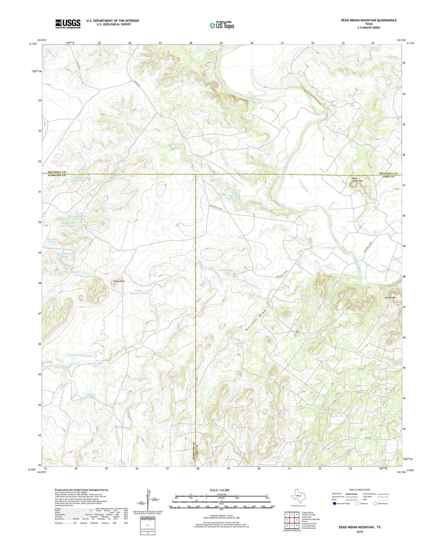
2022 topographic map quadrangle Dead Indian Mountain in the state of Texas. Scale: 1:24000. Based on the newly updated USGS 7.5' US Topo map series, this map is in the following counties: Coke, Mitchell, Sterling. The map contains contour data, water features, and other items you are used to seeing on USGS maps, but also has updated roads and other features. This is the next generation of topographic maps. Printed on high-quality waterproof paper with UV fade-resistant inks.
Quads adjacent to this one:
West: McWhorter Mountain
Northwest: Spade Ranch
North: Pecan Crossing
Northeast: Dam Draw
East: Silver
Southeast: Green Mountain
South: Crawford Slide
Southwest: Sterling City NW
This map covers the same area as the classic USGS quad with code o32100a7.
Contains the following named places: Catclaw Tank, Cedar Tank, County Line Tank, Dead Indian Mountain, Double Tanks, East Trap Tank, Gasconades Creek, Gasconades Tank, Harvey Martin Tank, Heifer Creek, Helfer Creek Tank, Jameson Oil Field, Lucky Strike Windmill, Nan Hatty Tank, Nan Hatty Tank Dam, North Gasconades Creek, North Tank, Old McWhorter Tank, Perkins Plant, Peter L Windmill, Powell Tank, Pyramid Tank, Scudday Tank, Shinney Tank, Snake Mountain, Snake Mountain Tank, South Gasconades Creek, Southeast Antelope Tank, Southwest Peter Lake Tank, Walnut Creek Tank, Westfall Draw, Wilson Mountain