
MyTopo
Slaton NE Texas US Topo Map
Couldn't load pickup availability
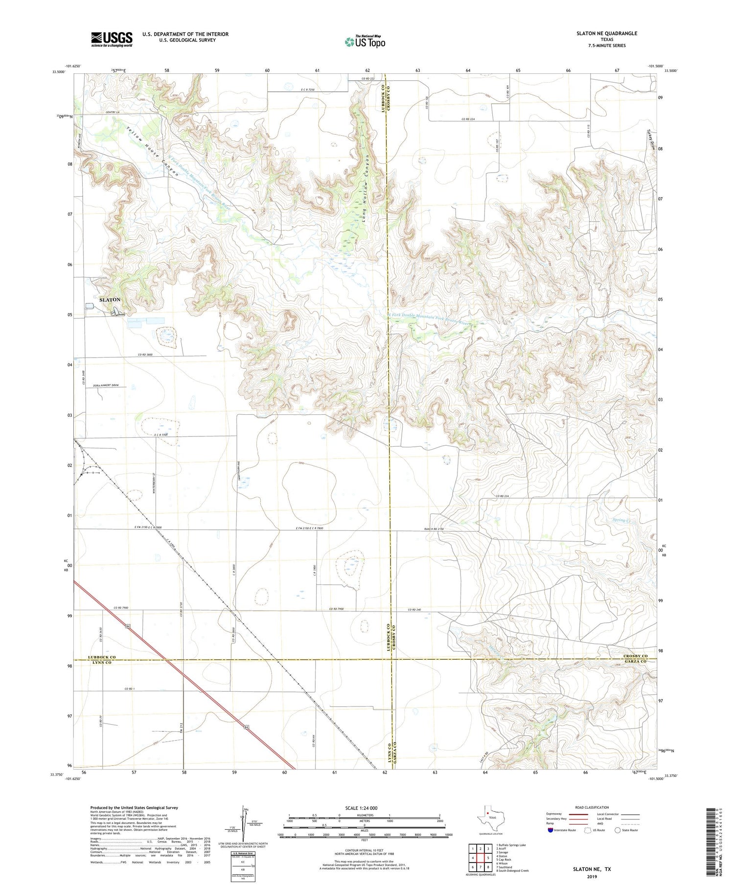
2019 topographic map quadrangle Slaton NE in the state of Texas. Scale: 1:24000. Based on the newly updated USGS 7.5' US Topo map series, this map is in the following counties: Lubbock, Crosby, Lynn, Garza. The map contains contour data, water features, and other items you are used to seeing on USGS maps, but also has updated roads and other features. This is the next generation of topographic maps. Printed on high-quality waterproof paper with UV fade-resistant inks.
Quads adjacent to this one:
West: Slaton
Northwest: Buffalo Springs Lake
North: Acuff
Northeast: Savage
East: Cap Rock
Southeast: South Dokegood Creek
South: Southland
Southwest: Wilson
Contains the following named places: Forest Ranch, Lazy K Ranch, Long Hollow Canyon, Mount Olive Baptist Church, V Ranch, Wood Ranch, Yellow House Canyon


