MyTopo
Sonora Texas US Topo Map
Couldn't load pickup availability
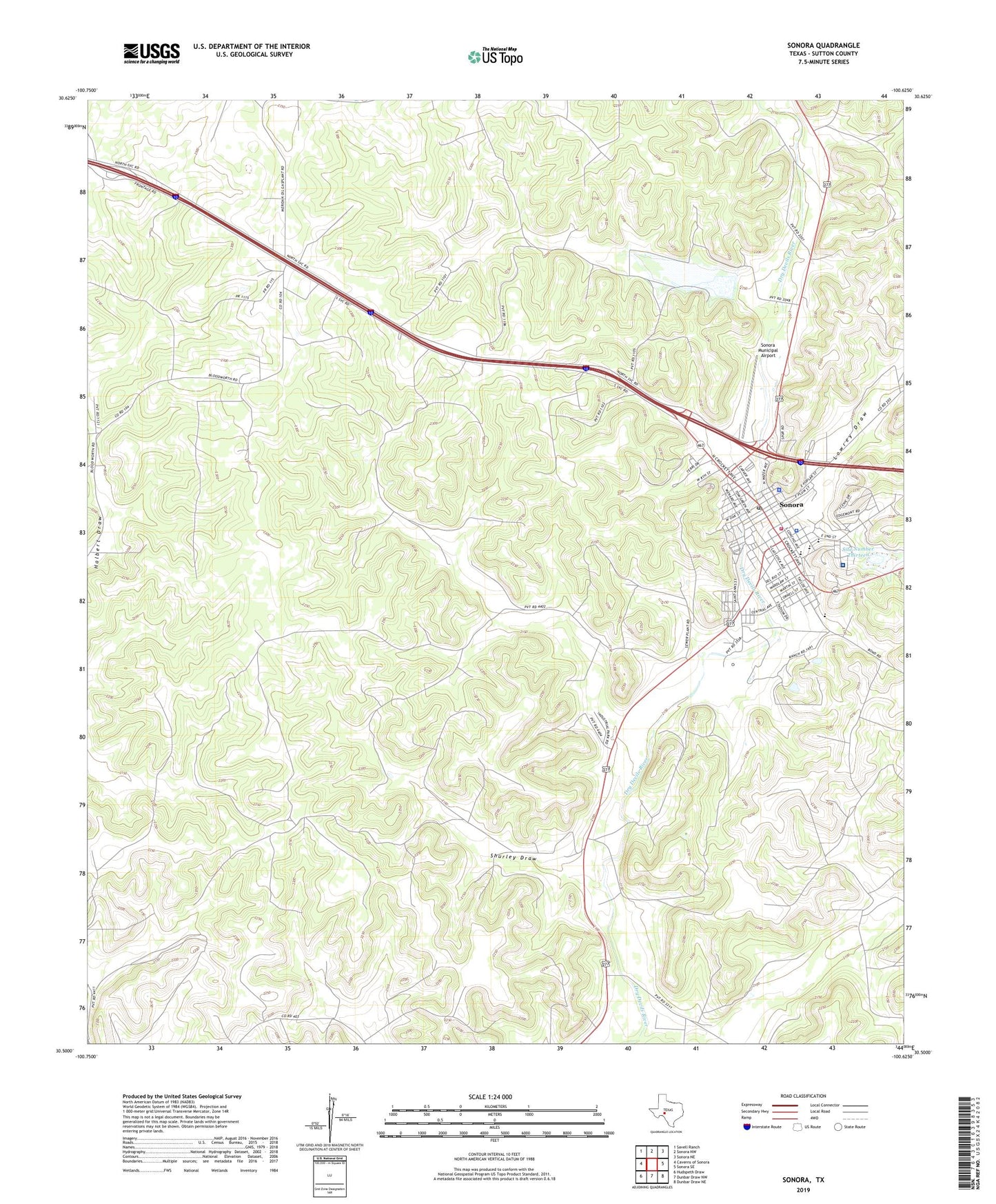
2019 topographic map quadrangle Sonora in the state of Texas. Scale: 1:24000. Based on the newly updated USGS 7.5' US Topo map series, this map is in the following counties: Sutton. The map contains contour data, water features, and other items you are used to seeing on USGS maps, but also has updated roads and other features. This is the next generation of topographic maps. Printed on high-quality waterproof paper with UV fade-resistant inks.
Quads adjacent to this one:
West: Caverns of Sonora
Northwest: Savell Ranch
North: Sonora NW
Northeast: Sonora NE
East: Sonora SE
Southeast: Dunbar Draw NE
South: Dunbar Draw NW
Southwest: Hudspeth Draw
Contains the following named places: Border Line Volunteer Fire Department, Church of Christ, City of Sonora, Elliott School, KBIT-TV (Sonora), KHOS-AM (Sonora), KHOS-FM (Sonora), Liberty Park, Lillian M Hudspeth Memorial Hospital, Lowrey Draw, Meckel Gas Field, Miers Home Museum, Old Mercantile Building, Presbyterian Church of the Good Shepherd, Saint Johns Episcopal Church, Shurley Draw, Site Number Eight, Site Number Thirteen, Soil Conservation Service Site 13 Dam, Soil Conservation Service Site 8 Dam, Soil Conservation Service Site 8 Reservoir, Sonora, Sonora Cemetery, Sonora City Hall, Sonora Elementary School, Sonora High School, Sonora Junior High School, Sonora Municipal Airport, Sonora Police Department, Sonora Post Office, Sutton County Courthouse, Sutton County Emergency Medical Service, Sutton County Jail, Sutton County Park, Sutton County Sheriff's Office