MyTopo
Southland Texas US Topo Map
Couldn't load pickup availability
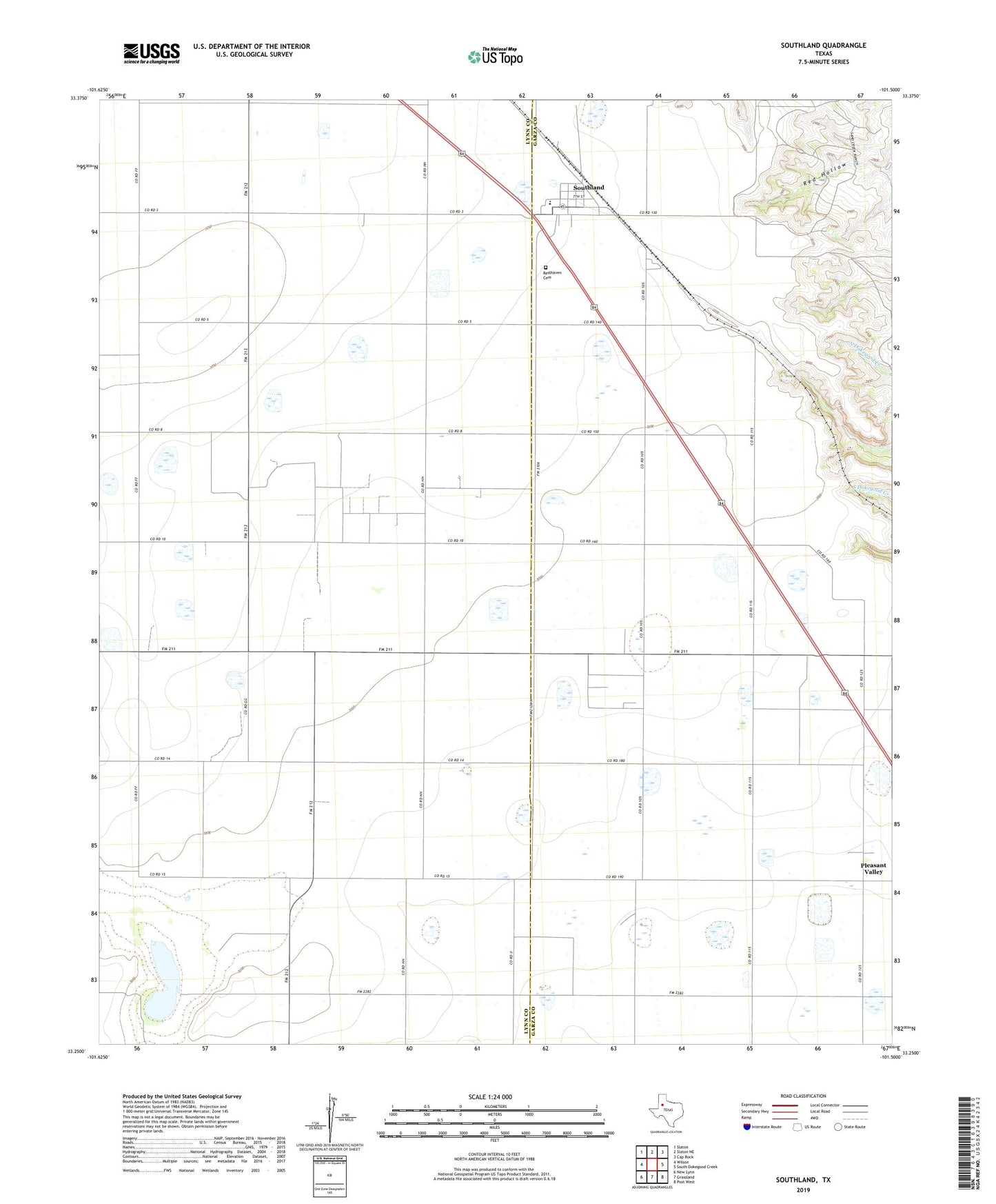
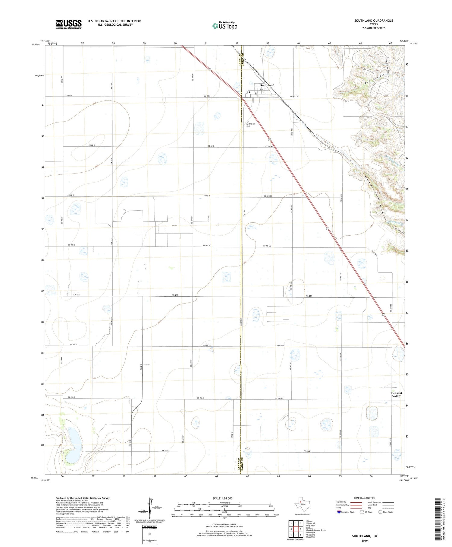
2019 topographic map quadrangle Southland in the state of Texas. Scale: 1:24000. Based on the newly updated USGS 7.5' US Topo map series, this map is in the following counties: Lynn, Garza. The map contains contour data, water features, and other items you are used to seeing on USGS maps, but also has updated roads and other features. This is the next generation of topographic maps. Printed on high-quality waterproof paper with UV fade-resistant inks.
Quads adjacent to this one:
West: Wilson
Northwest: Slaton
North: Slaton NE
Northeast: Cap Rock
East: South Dokegood Creek
Southeast: Post West
South: Grassland
Southwest: New Lynn
Contains the following named places: Gordon, Hackberry, Manley Lake, P H D Oil Field, Pleasant Valley, Resthaven Cemetery, Sandy Creek Lake, Sandy Creek Lake Dam, Southland, Suniland Oil Field