MyTopo
Post West Texas US Topo Map
Couldn't load pickup availability
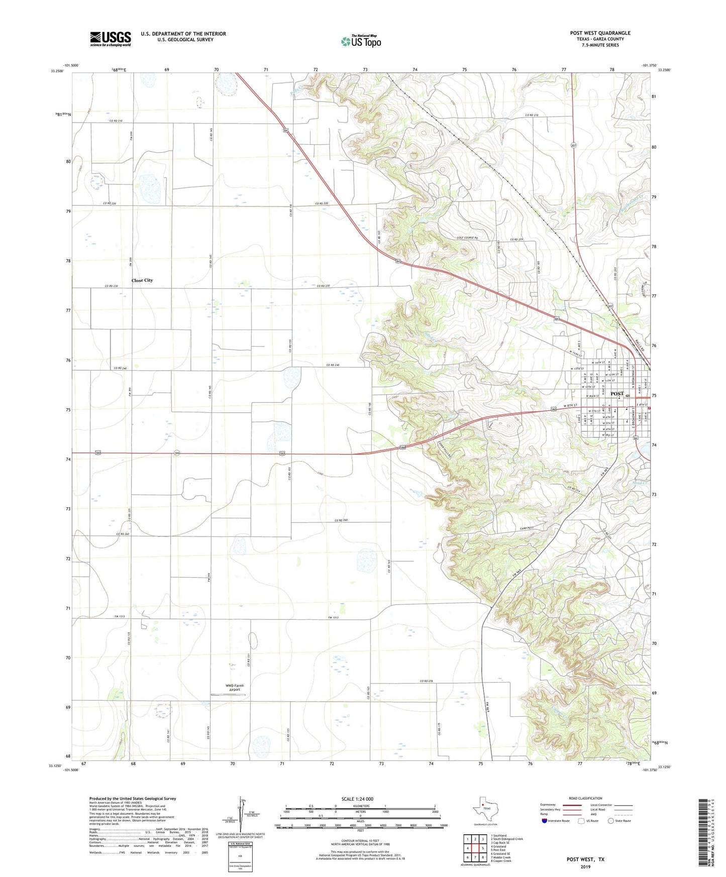
2022 topographic map quadrangle Post West in the state of Texas. Scale: 1:24000. Based on the newly updated USGS 7.5' US Topo map series, this map is in the following counties: Garza. The map contains contour data, water features, and other items you are used to seeing on USGS maps, but also has updated roads and other features. This is the next generation of topographic maps. Printed on high-quality waterproof paper with UV fade-resistant inks.
Quads adjacent to this one:
West: Grassland
Northwest: Southland
North: South Dokegood Creek
Northeast: Cap Rock SE
East: Post East
Southeast: Cooper Creek
South: Middle Creek
Southwest: Grassland SE
This map covers the same area as the classic USGS quad with code o33101b4.
Contains the following named places: Camp Post, Church of God of Prophecy, Church of the Nazarene, City of Post, Close City, Garza County Historical Museum, Garza Memorial Hospital, Graham, Huntley Oil Field, KNKC-FM (Post), KPOS-AM (Post), O S Ranch Museum, Old Algerita Hotel, Old Post Sanitarium, Post, Post - Garza County Emergency Medical Services, Post City Hall, Post Elementary School, Post High School, Post Middle School, Post Post Office, Post Volunteer Fire Department, Post West Division, Presbyterian Church, WWD Farms Airport