MyTopo
Taft Texas US Topo Map
Couldn't load pickup availability
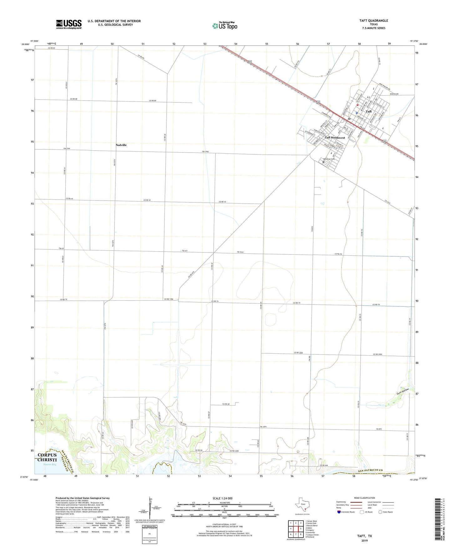
2019 topographic map quadrangle Taft in the state of Texas. Scale: 1:24000. Based on the newly updated USGS 7.5' US Topo map series, this map is in the following counties: San Patricio, Nueces. The map contains contour data, water features, and other items you are used to seeing on USGS maps, but also has updated roads and other features. This is the next generation of topographic maps. Printed on high-quality waterproof paper with UV fade-resistant inks.
Quads adjacent to this one:
West: Odem
Northwest: Sinton West
North: Sinton East
Northeast: Rincon Bend
East: Gregory
Southeast: Portland
South: Corpus Christi
Southwest: Annaville
Contains the following named places: Algodon Colonia, Alternative Education Campus Shoreline, Bellevue Cemetery, City of Taft, East Elementary School, East School, East White Point Oil Field, Faith Baptist Church, Faith Lutheran Church, Fifth Hidalgo Colonia, First Baptist Church of Taft, Fourth Hidalgo Colonia, KNCN-FM (Sinton), Mercury Emergency Medical Service, Midway Oil Field, Roosevelt Colonia, San Patricio County Constable's Office Precinct 8, Second Roosevelt Colonia, Shoreline Chemical Dependency Treatment Center, Sodville, South School, Taft, Taft Alternative Education Campus, Taft Blackland Museum, Taft City Hall, Taft City Park, Taft High School, Taft Junior High School, Taft Police Department, Taft Post Office, Taft Southwest Census Designated Place, Taft Volunteer Fire Department, Third Hidalgo Colonia, Tierra Buena Colonia, White Point Oil Field, Woodroe Petty Elementary School, ZIP Code: 78374