MyTopo
Odem Texas US Topo Map
Couldn't load pickup availability
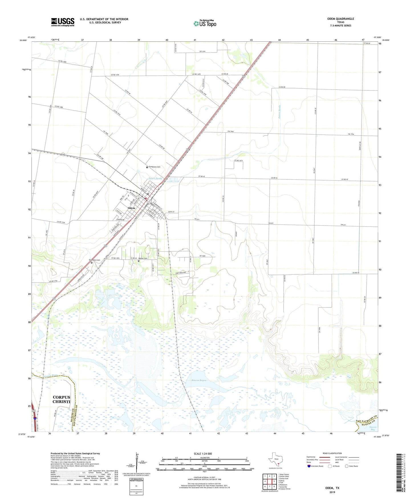
2022 topographic map quadrangle Odem in the state of Texas. Scale: 1:24000. Based on the newly updated USGS 7.5' US Topo map series, this map is in the following counties: San Patricio, Nueces. The map contains contour data, water features, and other items you are used to seeing on USGS maps, but also has updated roads and other features. This is the next generation of topographic maps. Printed on high-quality waterproof paper with UV fade-resistant inks.
Quads adjacent to this one:
West: Edroy
Northwest: West Sinton
North: Sinton West
Northeast: Sinton East
East: Taft
Southeast: Corpus Christi
South: Annaville
Southwest: Robstown
This map covers the same area as the classic USGS quad with code o27097h5.
Contains the following named places: Bethel Cemetery, Bethel Estates Number 1 Colonia, Bethel Estates Number 2 Colonia, Cheyene Colonia, City of Odem, Corpus Christi Filtration Plant, Evergreen Cemetery, Friendswood Acres Number 1 Colonia, Friendswood Acres Number 2 Colonia, KKHQ-FM (Odem), Odem, Odem City Hall, Odem Elementary School, Odem High School, Odem Junior High School, Odem Post Office, Odem Volunteer Fire Department, Rincon Bayou, San Pedro Cemetery, Spartan Oil Field, Sunrise Acres Colonia, Timon and Morgan Colonia, ZIP Code: 78370