MyTopo
Tatum Texas US Topo Map
Couldn't load pickup availability
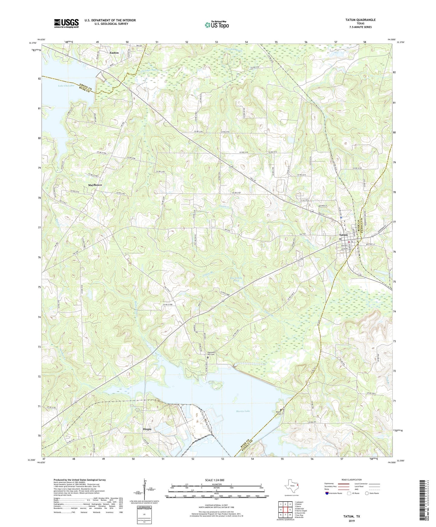
2019 topographic map quadrangle Tatum in the state of Texas. Scale: 1:24000. Based on the newly updated USGS 7.5' US Topo map series, this map is in the following counties: Rusk, Panola, Gregg. The map contains contour data, water features, and other items you are used to seeing on USGS maps, but also has updated roads and other features. This is the next generation of topographic maps. Printed on high-quality waterproof paper with UV fade-resistant inks.
Quads adjacent to this one:
West: Elderville
Northwest: Lakeport
North: Easton
Northeast: Darco
East: Harris Chapel
Southeast: Beckville
South: Fair Play
Southwest: Church Hill
Contains the following named places: Arbor, Camp Crosstie, Caney Branch, Cherokee Dam, Cherry Slough, City of Tatum, Crystal Farms Church, Dirgin, Doc Young Pond, Doc Young Pond Dam, First Baptist Church, Friendship Church, Harmony Hill Cemetery, Lake Cherokee, Martin Cemetery, Martin Creek Dam, Martin Creek Lake State Park, Martin Creek Lake State Park Trail, Mayflower, Mud Creek, Panther Creek, Rocky Ford Creek, Smith Chapel, Tatum, Tatum City Hall, Tatum Creek, Tatum Division, Tatum Elementary School, Tatum Gas Field, Tatum Middle School, Tatum on the Santa Fe Museum, Tatum Police Department, Tatum Post Office, Tatum Primary School, Tatum Volunteer Fire Department - First Responders, Taylor Branch, Union Church, Zion Hill Church, ZIP Code: 75691