
MyTopo
The Falls Texas US Topo Map
Couldn't load pickup availability
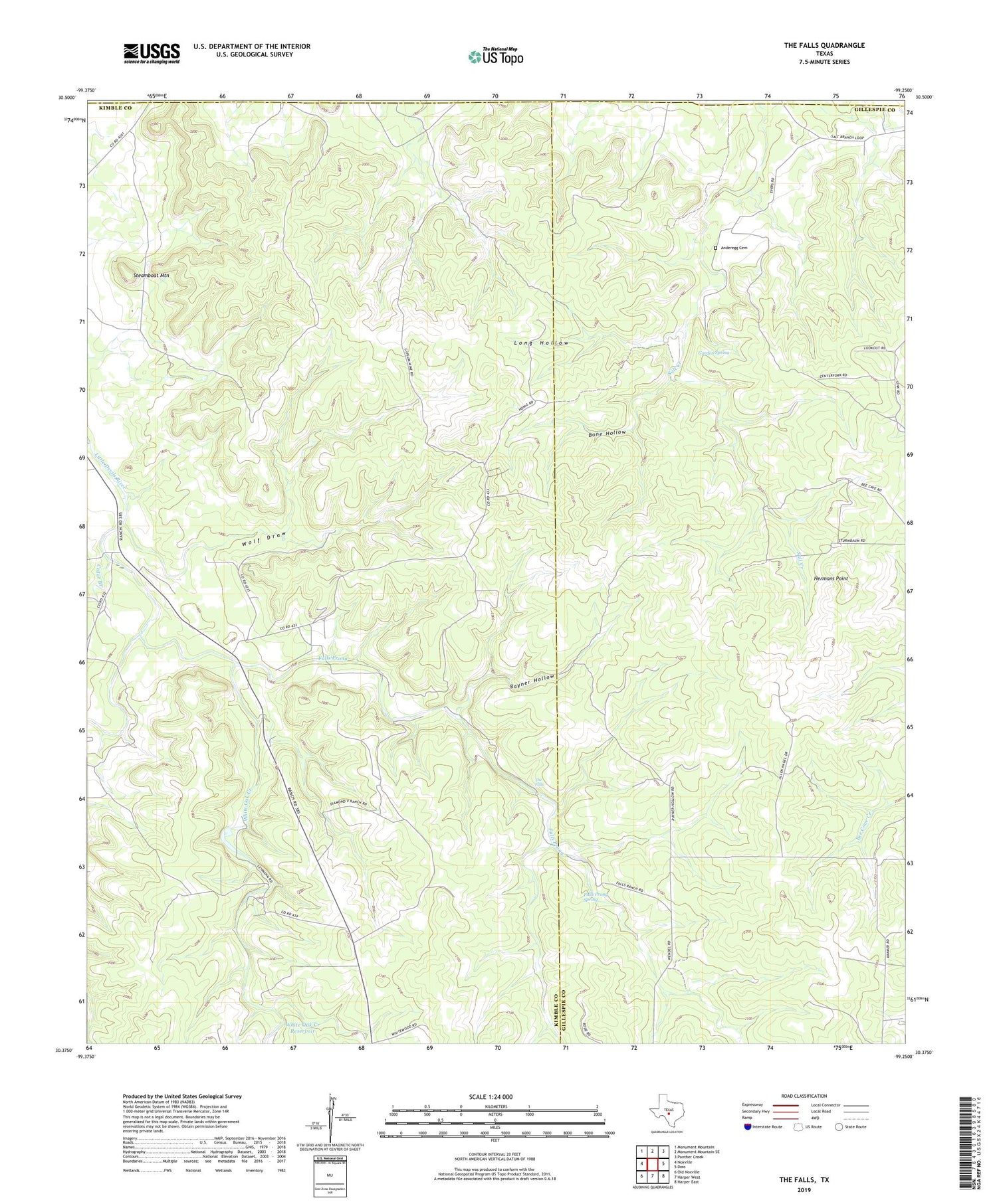
2019 topographic map quadrangle The Falls in the state of Texas. Scale: 1:24000. Based on the newly updated USGS 7.5' US Topo map series, this map is in the following counties: Kimble, Gillespie, Mason. The map contains contour data, water features, and other items you are used to seeing on USGS maps, but also has updated roads and other features. This is the next generation of topographic maps. Printed on high-quality waterproof paper with UV fade-resistant inks.
Quads adjacent to this one:
West: Noxville
Northwest: Monument Mountain
North: Monument Mountain SE
Northeast: Panther Creek
East: Doss
Southeast: Harper East
South: Harper West
Southwest: Old Noxville
Contains the following named places: Anderegg Cemetery, Bierschwale Windmill, Bone Hollow, Cedar Branch, Falls Prong, Falls Prong Spring, Falls Prong Windmill, Garden Spring, Hermans Point, Little Windmill, Long Hollow, North Windmill, Old Windmill, Rayner Hollow, Rock House Windmill, Rodgers Trap Windmill, Section Windmill, Steamboat Mountain, The Falls, White Oak Creek, White Oak Creek Reservoir, Wolf Draw


