MyTopo
Throckmorton Texas US Topo Map
Couldn't load pickup availability
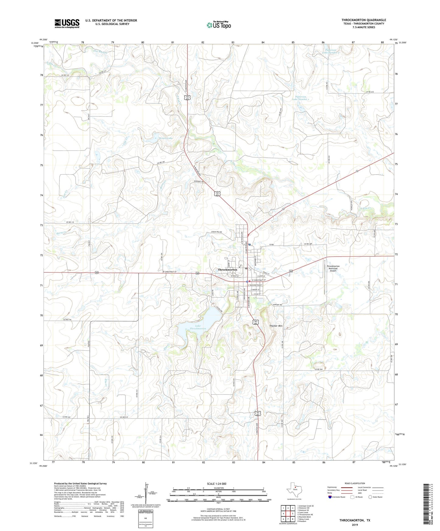
2019 topographic map quadrangle Throckmorton in the state of Texas. Scale: 1:24000. Based on the newly updated USGS 7.5' US Topo map series, this map is in the following counties: Throckmorton. The map contains contour data, water features, and other items you are used to seeing on USGS maps, but also has updated roads and other features. This is the next generation of topographic maps. Printed on high-quality waterproof paper with UV fade-resistant inks.
Quads adjacent to this one:
West: Tonk Creek
Northwest: Antelope Creek SE
North: Westover SW
Northeast: Westover SE
East: Throckmorton NE
Southeast: Woodson
South: Sibley Creek
Southwest: Reynolds Bend
Contains the following named places: Brown Lake, Brown Lake Dam, Cow Creek, First Baptist Church, Flat Rock Creek, Horse Creek, Lake Throckmorton, Lake Throckmorton Dam, Patterson Lake Number 1, Patterson Lake Number 1 Dam, Patterson Lake Number 2, Patterson Lake Number 2 Dam, Thacker Mountain, Throckmorton, Throckmorton City Hall, Throckmorton County, Throckmorton County Jail, Throckmorton County Memorial Hospital, Throckmorton County Sheriff's Office, Throckmorton Division, Throckmorton Elementary School, Throckmorton High School, Throckmorton Municipal Airport, Throckmorton Post Office, Throckmorton Volunteer Fire Department, Town of Throckmorton