MyTopo
Reynolds Bend Texas US Topo Map
Couldn't load pickup availability
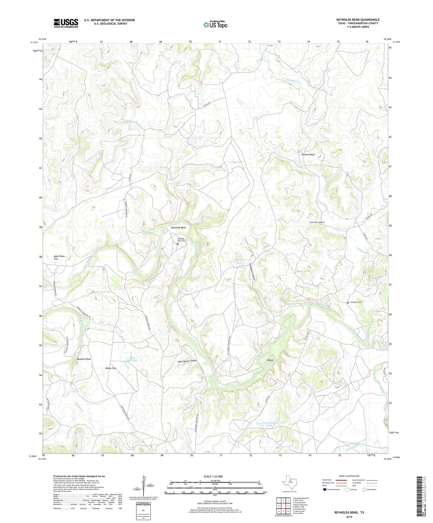
2022 topographic map quadrangle Reynolds Bend in the state of Texas. Scale: 1:24000. Based on the newly updated USGS 7.5' US Topo map series, this map is in the following counties: Throckmorton. The map contains contour data, water features, and other items you are used to seeing on USGS maps, but also has updated roads and other features. This is the next generation of topographic maps. Printed on high-quality waterproof paper with UV fade-resistant inks.
Quads adjacent to this one:
West: Hoover Mountain
Northwest: Reynolds Bend NW
North: Tonk Creek
Northeast: Throckmorton
East: Sibley Creek
Southeast: Fort Griffin
South: Collins Creek
Southwest: Antelope Hills
This map covers the same area as the classic USGS quad with code o33099a3.
Contains the following named places: Bake Oven Flat, Bartholomew Crossing, Buzzard Peak, Buzzard Peak Corral, Buzzard Peak Crossing, Camp Cooper Tank, Clay Tank, Gentry Crossing, Graveyard Canyon, Hayford Crossing, Hittson Bluff, John House Canyon, Lime Kiln Canyon, McKeichan Crossing, Paint Creek, Paint Crossing, Ranger Creek, Reynolds Bend, Reynolds Bend Cemetery, Reynolds Crossing, Rocky Creek, Rocky Tank, S Bend, Tecumseh Creek, Telephone Tank, Treadwell Cemetery, Walnut Creek, White Flat, White Flat Tank, Wildcat Tank