MyTopo
Tornillo Texas US Topo Map
Couldn't load pickup availability
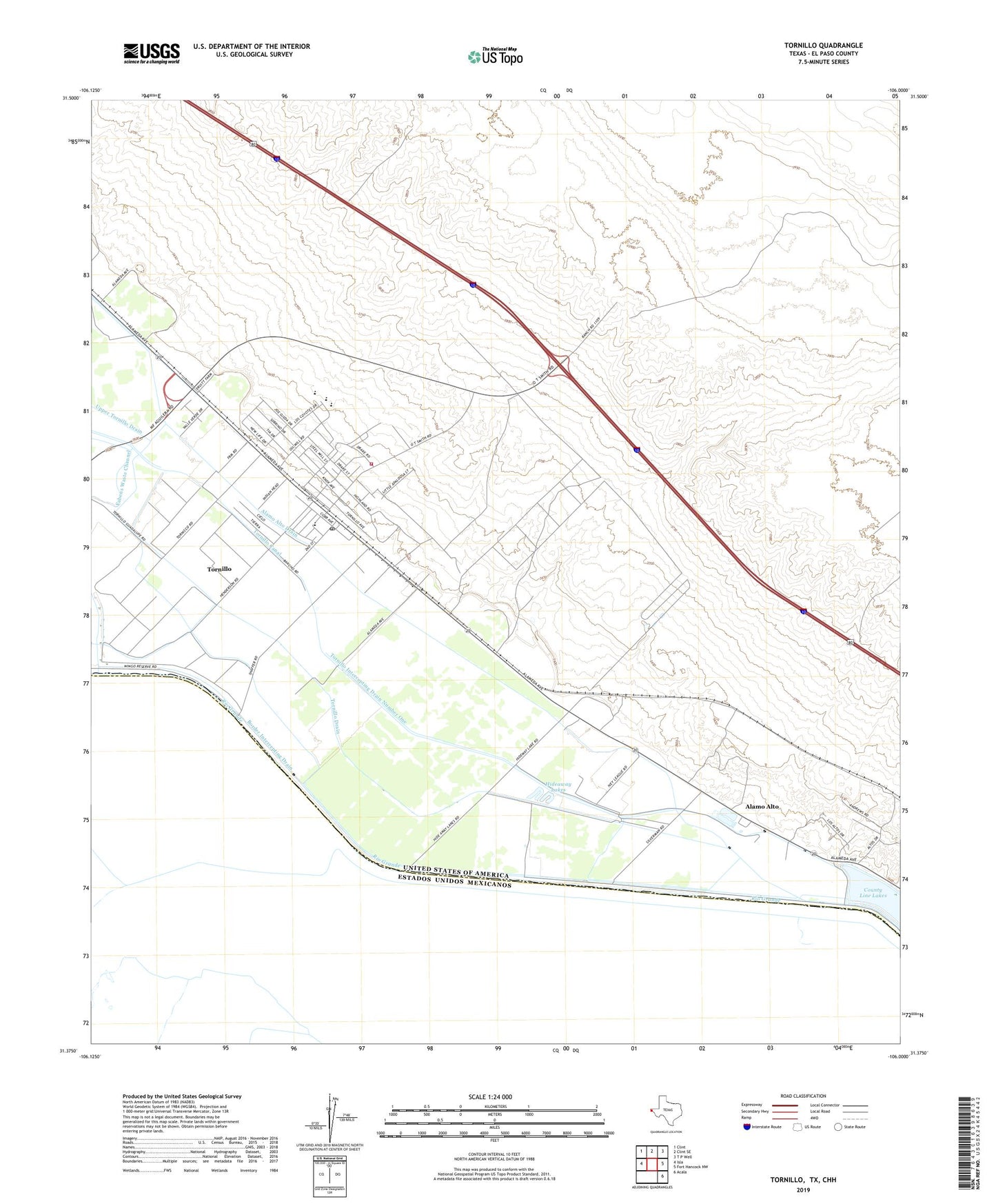
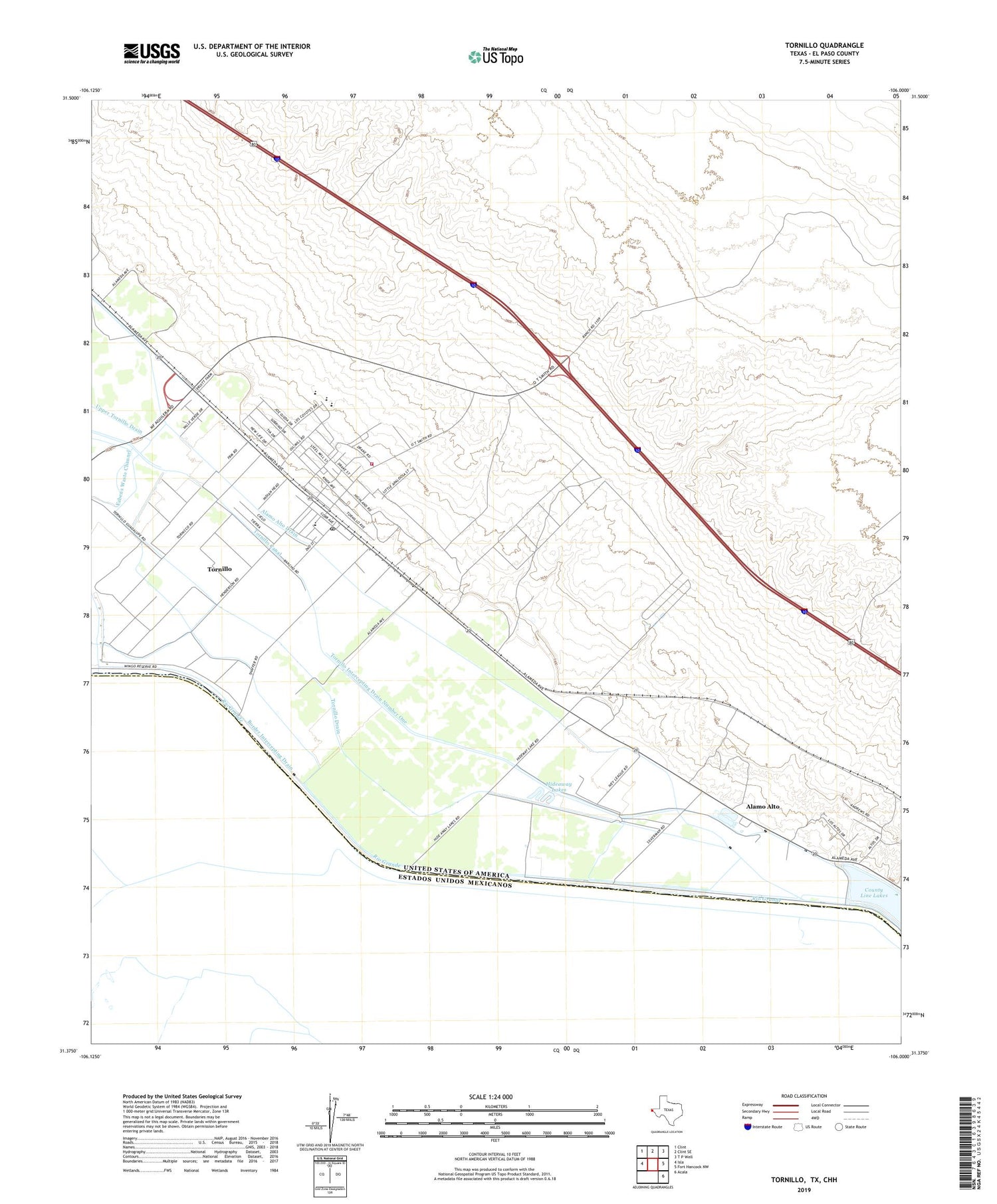
2019 topographic map quadrangle Tornillo in the state of Texas. Scale: 1:24000. Based on the newly updated USGS 7.5' US Topo map series, this map is in the following counties: El Paso. The map contains contour data, water features, and other items you are used to seeing on USGS maps, but also has updated roads and other features. This is the next generation of topographic maps. Printed on high-quality waterproof paper with UV fade-resistant inks.
Quads adjacent to this one:
West: Isla
Northwest: Clint
North: Clint SE
Northeast: T P Well
East: Fort Hancock NW
Southeast: Acala
Contains the following named places: Alamo Alto, Alamo Alto Drain, Alamo Alto Gaging Station, Border Intercepting Drain, Burris Crossing, County Line Lakes, Fabens Fire and Rescue Tornillo Substation, Fabens Waste Channel, Hideaway Lakes, Iveys Crossing, Tornillo, Tornillo Canal, Tornillo Census Designated Place, Tornillo Drain, Tornillo Feed Yards Airport, Tornillo Intercepting Drain Number One, Tornillo Post Office, ZIP Code: 79853