
MyTopo
Tuleta Texas US Topo Map
Couldn't load pickup availability
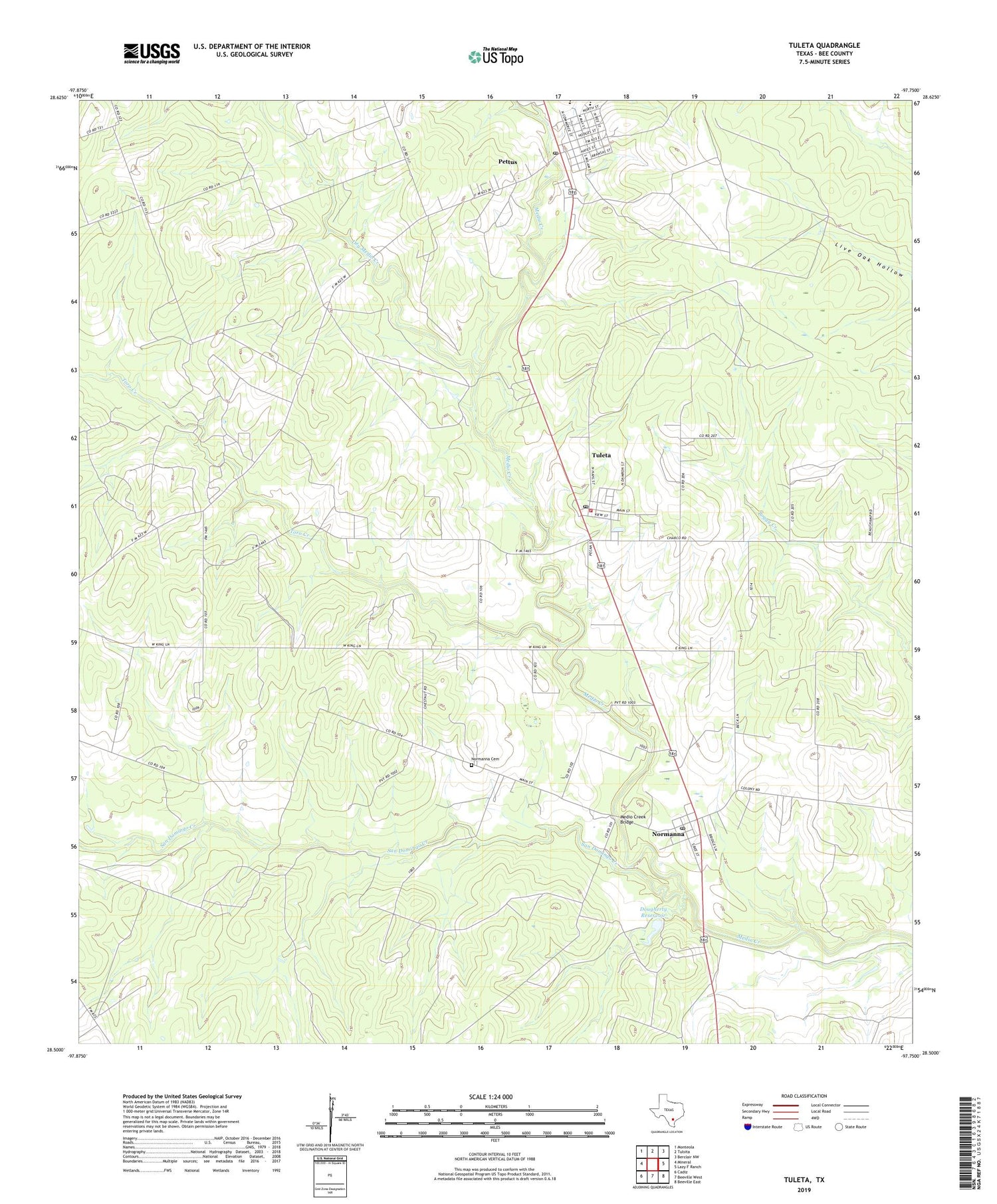
2019 topographic map quadrangle Tuleta in the state of Texas. Scale: 1:24000. Based on the newly updated USGS 7.5' US Topo map series, this map is in the following counties: Bee. The map contains contour data, water features, and other items you are used to seeing on USGS maps, but also has updated roads and other features. This is the next generation of topographic maps. Printed on high-quality waterproof paper with UV fade-resistant inks.
Quads adjacent to this one:
West: Mineral
Northwest: Monteola
North: Tulsita
Northeast: Berclair NW
East: Lazy F Ranch
Southeast: Beeville East
South: Beeville West
Southwest: Cadiz
Contains the following named places: Bee County Constable's Office Precinct 2, Cosden West Oil Field, Dirks Oil Field, Dougherty Reservoir, Dougherty Reservoir Dam, Dry Medio Creek, Hall Ranch, Medio Creek Bridge, Normanna, Normanna Census Designated Place, Normanna Gas Field, Normanna Post Office, Pettus, Pettus - Tuleta Volunteer Fire Department First Responders, Pettus Census Designated Place, Pettus Elementary School, Pettus High School, Pettus Oil Field, Pettus Post Office, Ray Oil Field, San Domingo Cemetery, San Domingo Creek, San Domingo Oil Field, San Domingo Ranch, Toro Creek, Tuleta, Tuleta Census Designated Place, Tuleta Post Office, Tulsita Oil Field, West Tuleta Oil Field, ZIP Codes: 78104, 78142, 78146, 78162


