MyTopo
Monteola Texas US Topo Map
Couldn't load pickup availability
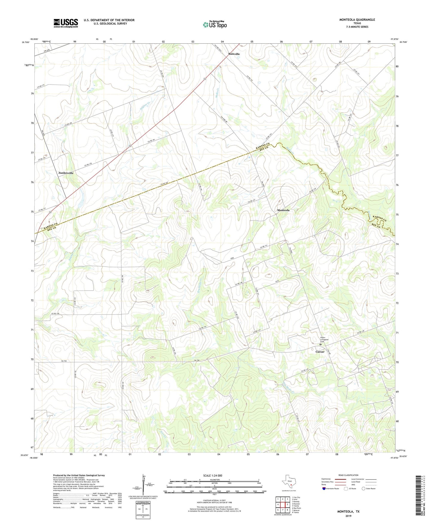
2022 topographic map quadrangle Monteola in the state of Texas. Scale: 1:24000. Based on the newly updated USGS 7.5' US Topo map series, this map is in the following counties: Bee, Karnes. The map contains contour data, water features, and other items you are used to seeing on USGS maps, but also has updated roads and other features. This is the next generation of topographic maps. Printed on high-quality waterproof paper with UV fade-resistant inks.
Quads adjacent to this one:
West: Pawnee
Northwest: Coy City
North: Lenz
Northeast: Kenedy
East: Tulsita
Southeast: Tuleta
South: Mineral
Southwest: Ray Point
This map covers the same area as the classic USGS quad with code o28097f8.
Contains the following named places: Bainville, Caesar, Caesar Oil Field, Elim Church, Monteola, Pullin-Livingston Cemetery, Zunkerville, ZIP Codes: 78119, 78145