MyTopo
Tulia Texas US Topo Map
Couldn't load pickup availability
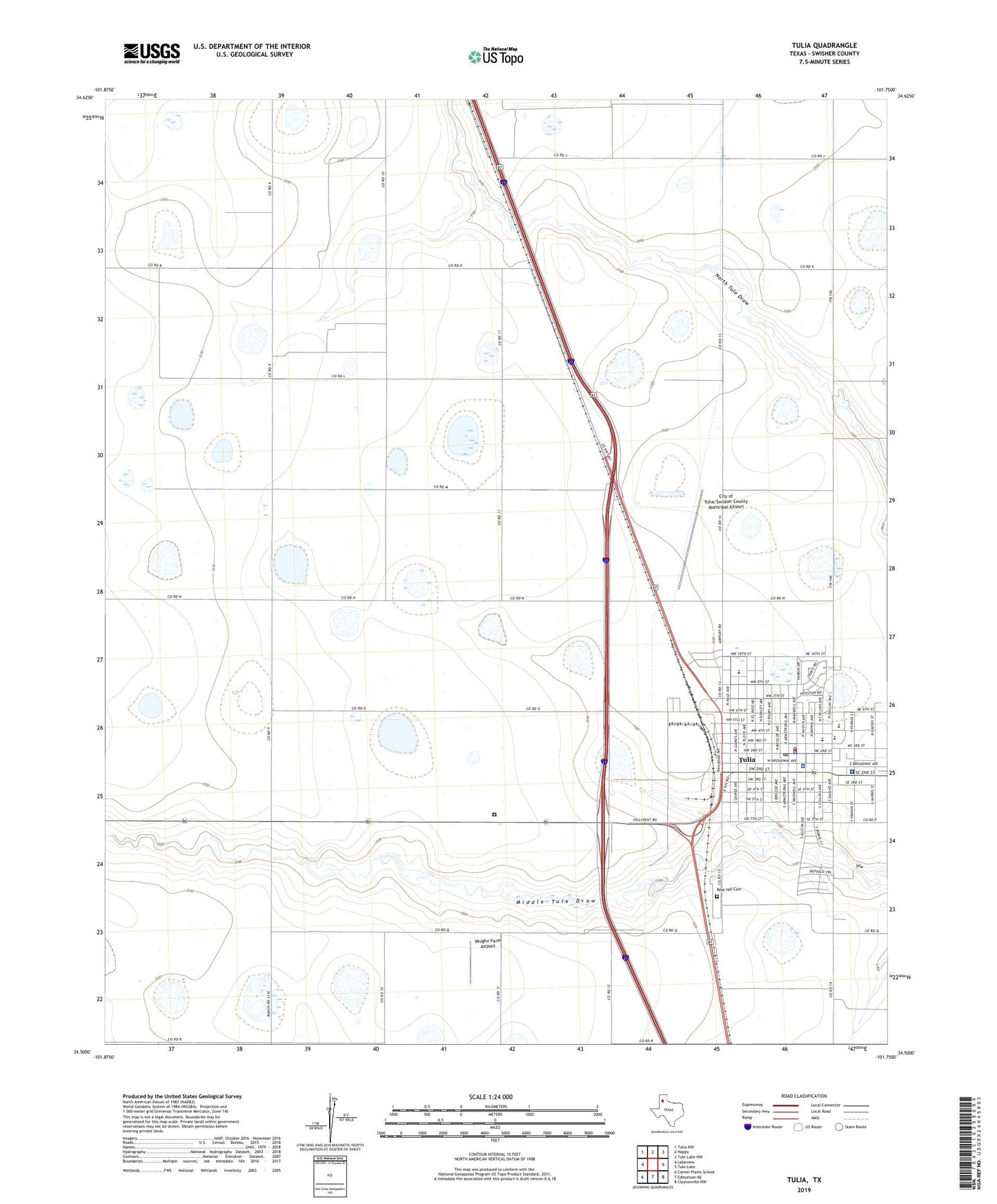
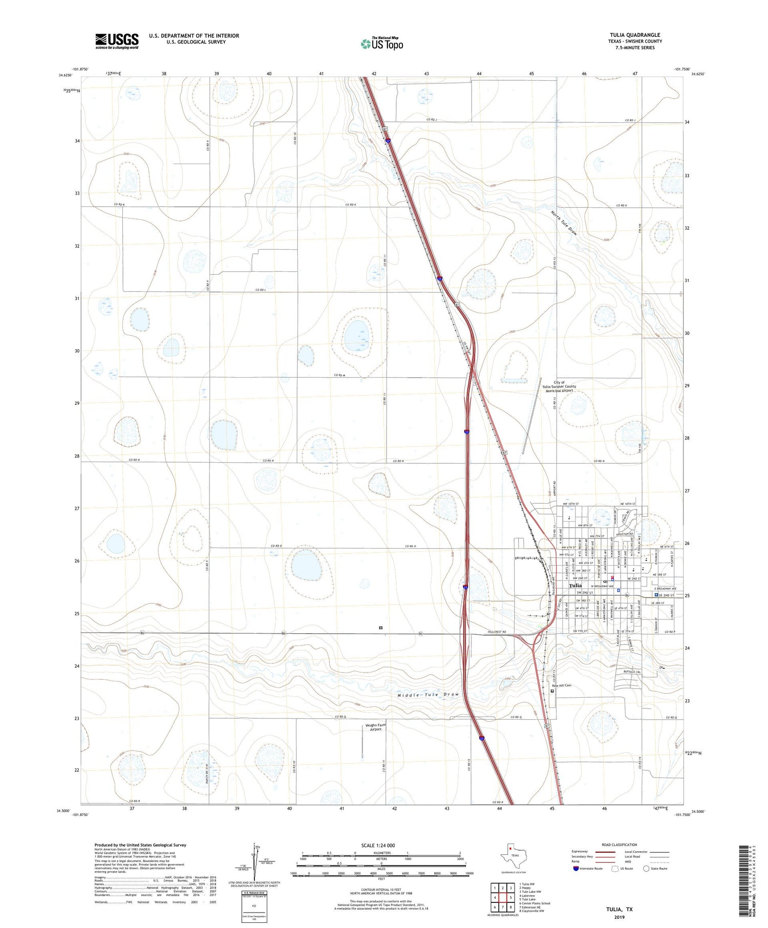
2019 topographic map quadrangle Tulia in the state of Texas. Scale: 1:24000. Based on the newly updated USGS 7.5' US Topo map series, this map is in the following counties: Swisher. The map contains contour data, water features, and other items you are used to seeing on USGS maps, but also has updated roads and other features. This is the next generation of topographic maps. Printed on high-quality waterproof paper with UV fade-resistant inks.
Quads adjacent to this one:
West: Lakeview
Northwest: Tulia NW
North: Happy
Northeast: Tule Lake NW
East: Tule Lake
Southeast: Claytonville NW
South: Edmonson NE
Southwest: Center Plains School
Contains the following named places: Adair Park, Calvary Church, Christ Evangelical Lutheran Church, Church of Christ, City of Tulia, City of Tulia/Swisher County Municipal Airport, Donley Park, East Ward School, KJMX-FM (Tulia), KTUE-AM (Tulia), MacKenzie Park, Rose Hill Cemetery, Swinburn Elementary School, Swisher County Jail, Swisher County Museum, Swisher County Sheriff's Office, Swisher Memorial Hospital, Texas Department of Criminal Justice Tulia Transfer Facility, Tule Creek Emergency Medical Service, Tulia, Tulia City Hall, Tulia High School, Tulia Highland Elementary School, Tulia Junior High School, Tulia Police Department, Tulia Post Office, Tulia Seventh Day Adventist Church, Tulia Volunteer Fire Department, Vaughn Farm Airport, Younger Field