
MyTopo
Umbarger Texas US Topo Map
Couldn't load pickup availability
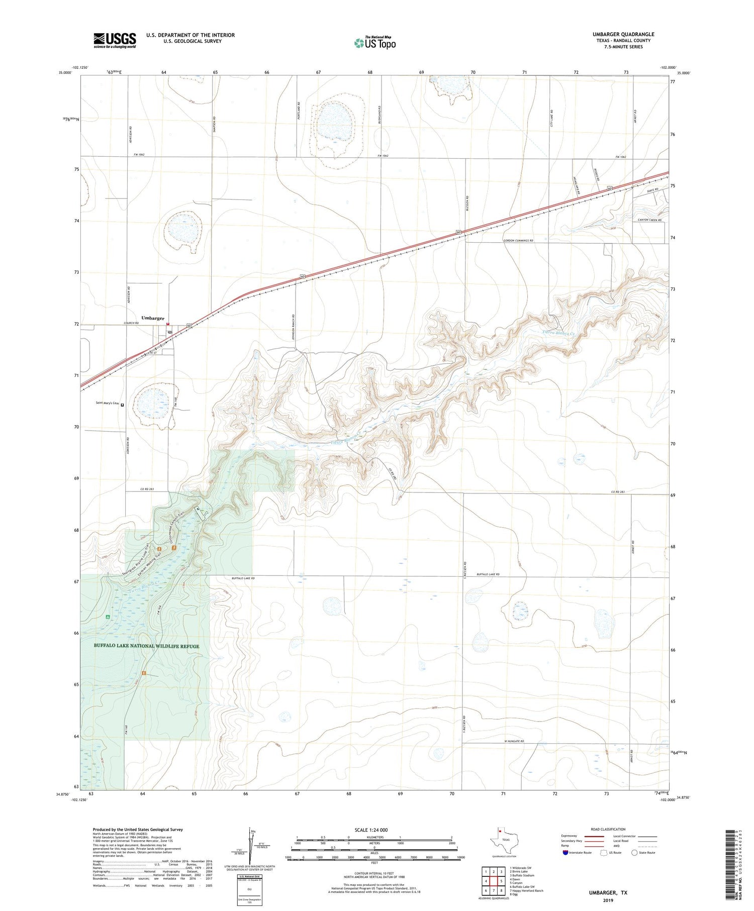
2019 topographic map quadrangle Umbarger in the state of Texas. Scale: 1:24000. Based on the newly updated USGS 7.5' US Topo map series, this map is in the following counties: Randall. The map contains contour data, water features, and other items you are used to seeing on USGS maps, but also has updated roads and other features. This is the next generation of topographic maps. Printed on high-quality waterproof paper with UV fade-resistant inks.
Quads adjacent to this one:
West: Dawn
Northwest: Wildorado SW
North: Bivins Lake
Northeast: Buffalo Stadium
East: Canyon
Southeast: Ogg
South: Happy Hereford Ranch
Southwest: Buffalo Lake SW
Contains the following named places: Buffalo Lake, Buffalo Lake National Wildlife Refuge, Flying Mare Ranch, Randall County Fire and Rescue Station 3, Saint Marys Catholic Church, Saint Mary's Cemetery, Seven B Ranch, Umbarger, Umbarger Census Designated Place, Umbarger Dam, Umbarger Post Office


