MyTopo
Union Center Texas US Topo Map
Couldn't load pickup availability
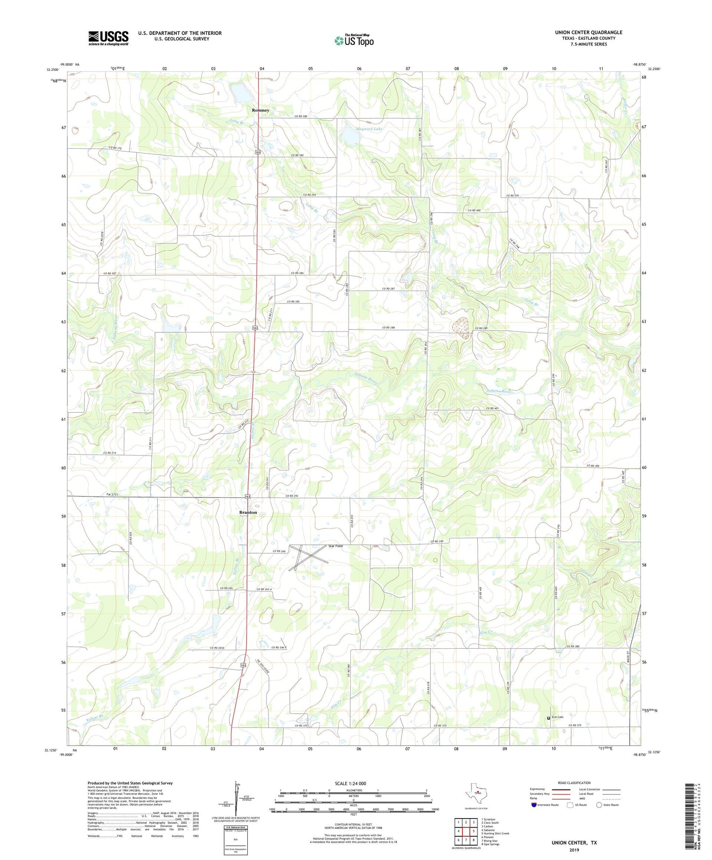
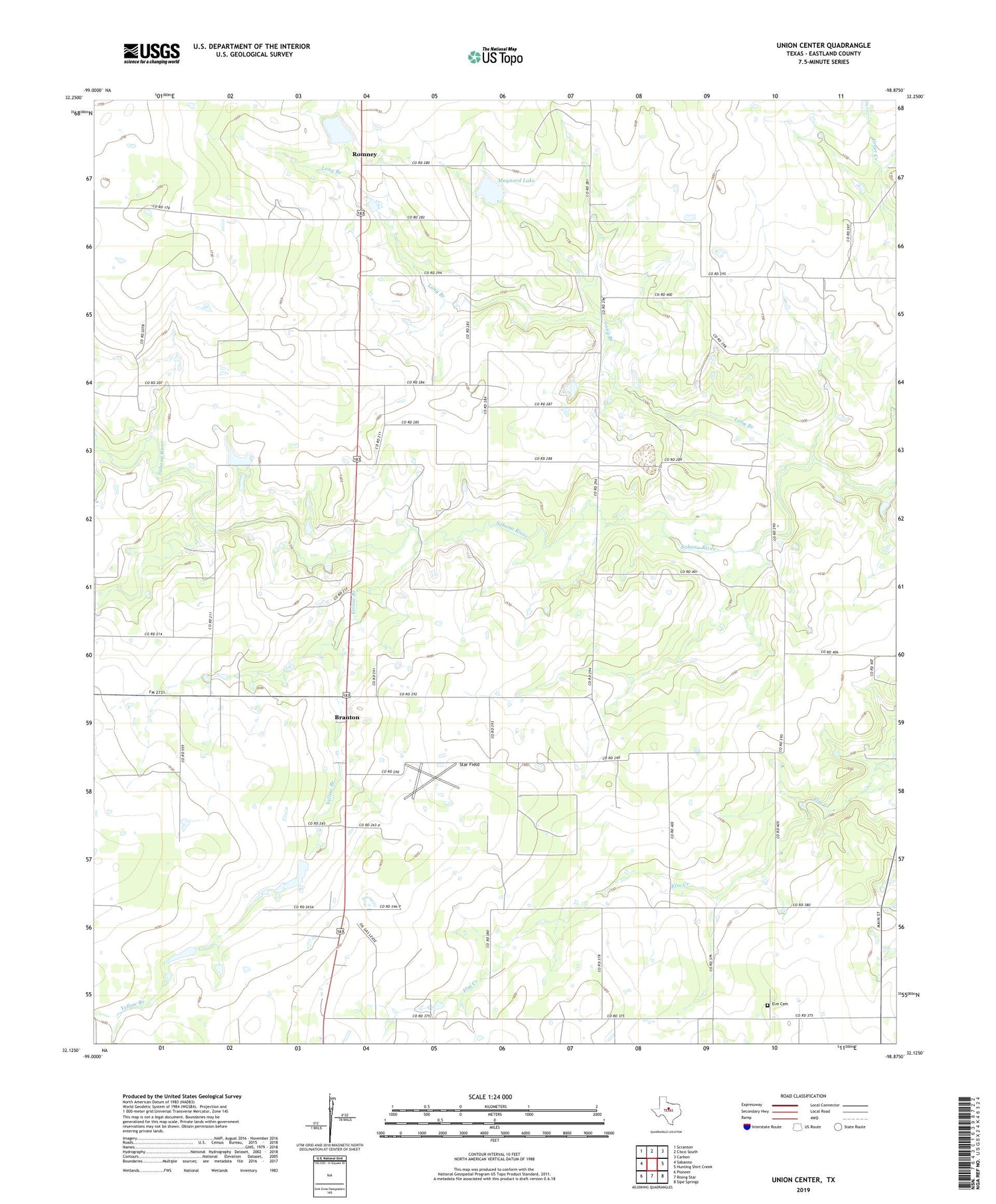
2019 topographic map quadrangle Union Center in the state of Texas. Scale: 1:24000. Based on the newly updated USGS 7.5' US Topo map series, this map is in the following counties: Eastland. The map contains contour data, water features, and other items you are used to seeing on USGS maps, but also has updated roads and other features. This is the next generation of topographic maps. Printed on high-quality waterproof paper with UV fade-resistant inks.
Quads adjacent to this one:
West: Sabanno
Northwest: Scranton
North: Cisco South
Northeast: Carbon
East: Hunting Shirt Creek
Southeast: Sipe Springs
South: Rising Star
Southwest: Pioneer
Contains the following named places: Branton, Elm Cemetery, Long Branch, Long Branch Church, Maynord Lake, Maynord Lake Dam, Mountain Top, Mountain Top Church, Okra, Rising Star Division, Romney, Star Field, Union Center, Yellow Branch