MyTopo
Hunting Shirt Creek Texas US Topo Map
Couldn't load pickup availability
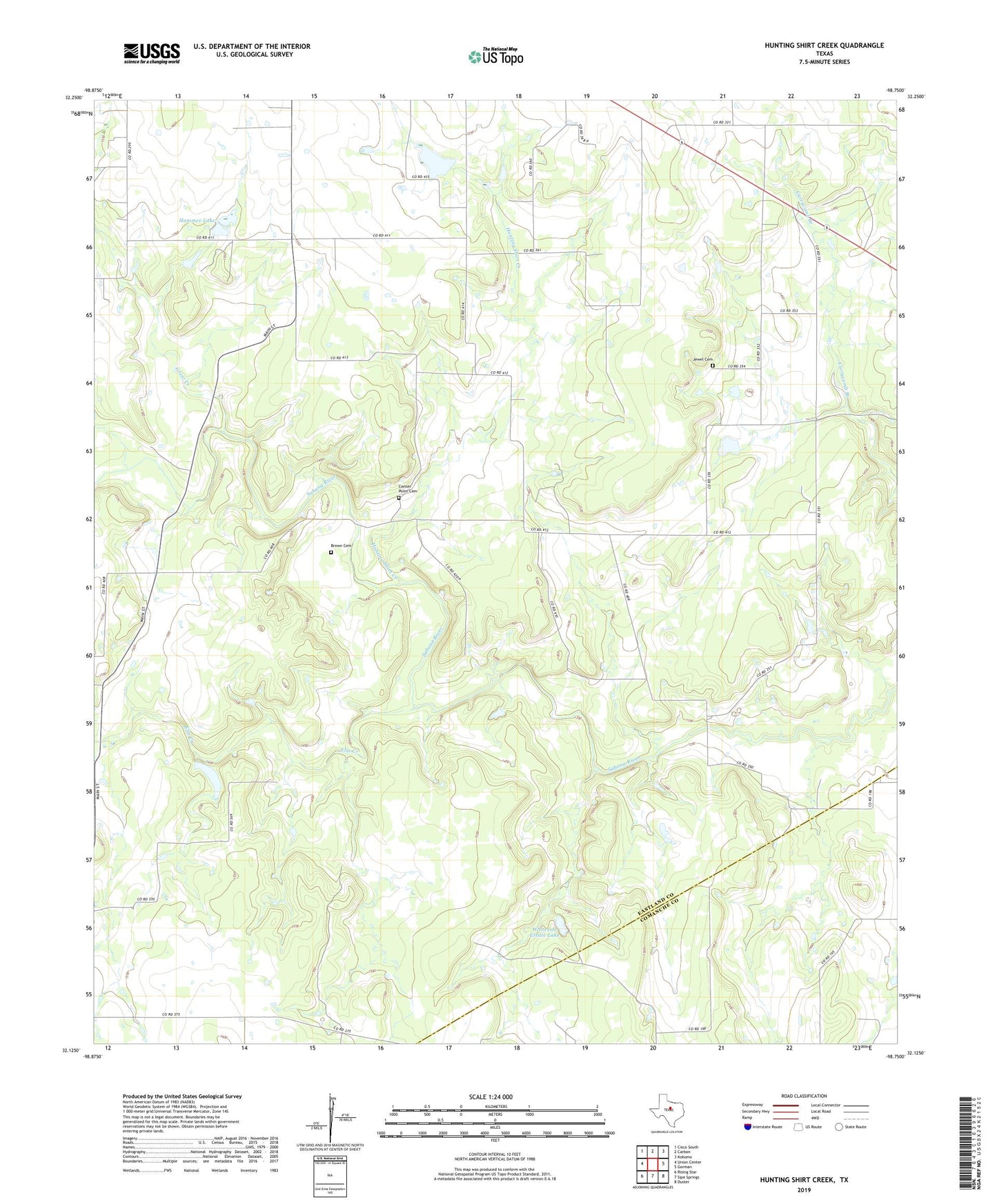
2022 topographic map quadrangle Hunting Shirt Creek in the state of Texas. Scale: 1:24000. Based on the newly updated USGS 7.5' US Topo map series, this map is in the following counties: Eastland, Comanche. The map contains contour data, water features, and other items you are used to seeing on USGS maps, but also has updated roads and other features. This is the next generation of topographic maps. Printed on high-quality waterproof paper with UV fade-resistant inks.
Quads adjacent to this one:
West: Union Center
Northwest: Cisco South
North: Carbon
Northeast: Kokomo
East: Gorman
Southeast: Duster
South: Sipe Springs
Southwest: Rising Star
This map covers the same area as the classic USGS quad with code o32098b7.
Contains the following named places: Brown Cemetery, Center Point Cemetery, Elm Creek, Greer Creek, Hammer Lake, Hamner Dam, Hunting Shirt Creek, Jewel Cemetery, Truett Spruill Dam, Truett Spruill Lake, Whiteside Estate Lake, Whiteside Estate Lake Dam, ZIP Code: 76435