MyTopo
Warren Texas US Topo Map
Couldn't load pickup availability
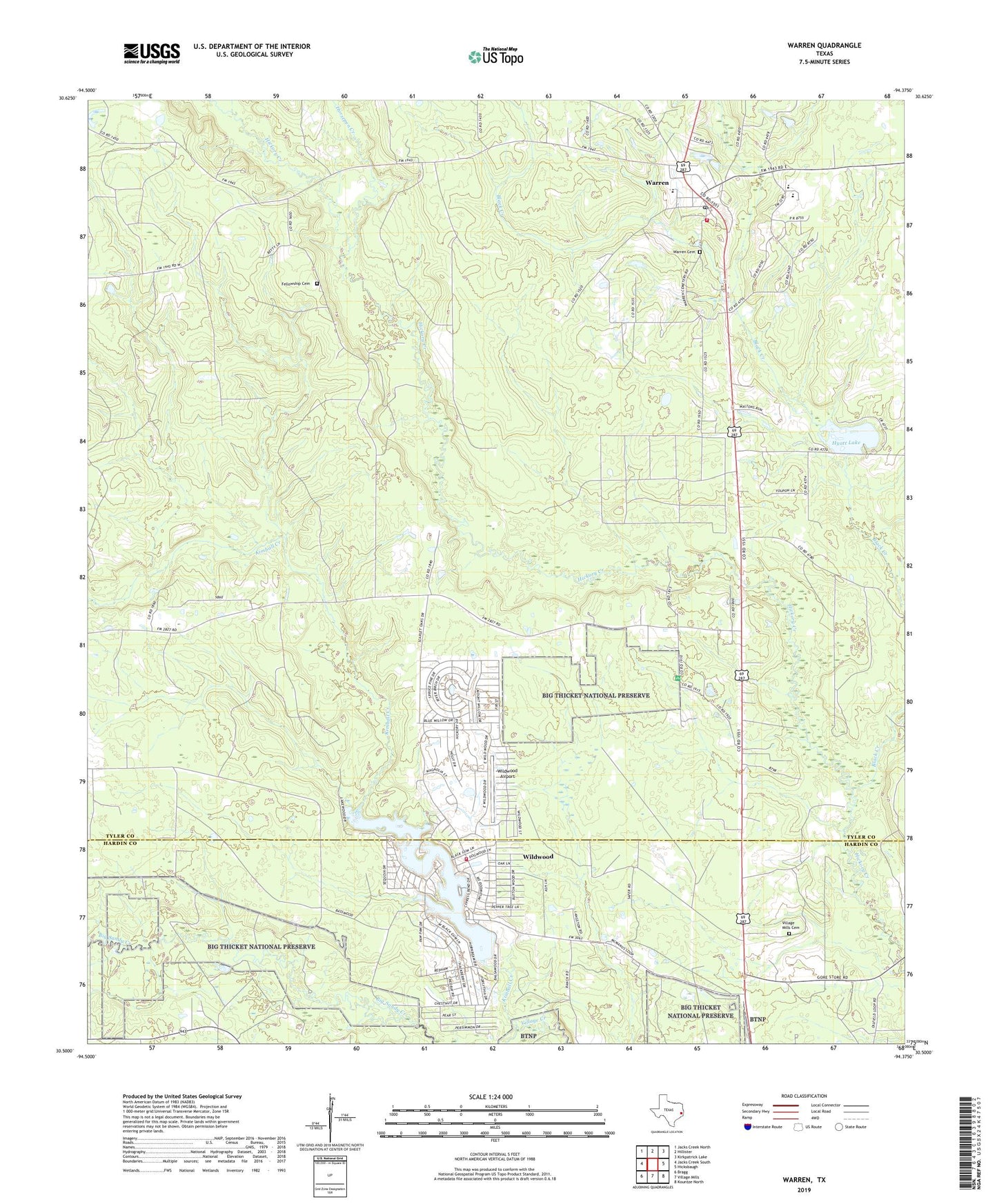
2019 topographic map quadrangle Warren in the state of Texas. Scale: 1:24000. Based on the newly updated USGS 7.5' US Topo map series, this map is in the following counties: Tyler, Hardin. The map contains contour data, water features, and other items you are used to seeing on USGS maps, but also has updated roads and other features. This is the next generation of topographic maps. Printed on high-quality waterproof paper with UV fade-resistant inks.
Quads adjacent to this one:
West: Jacks Creek South
Northwest: Jacks Creek North
North: Hillister
Northeast: Kirkpatrick Lake
East: Hicksbaugh
Southeast: Kountze North
South: Village Mills
Southwest: Bragg
Contains the following named places: Big Sandy Creek, Big Thicket - Sundew Trail, Black Creek, Fellowship Cemetery, Horsepen Creek, Hyatt, Hyatt Lake, Hyatt Lake Dam, Hyatt Lookout, John H Kirby State Forest, Kimball Creek, Longleaf Nature Trail, Mill Creek Church, Pavey Oil Field, Red Oak School, Village Mills Cemetery, Village Mills Post Office, Warren, Warren Cemetery, Warren Census Designated Place, Warren Division, Warren Post Office, Warren Volunteer Fire Department, West Village Mills Oil Field, Wildwood, Wildwood Airport, Wildwood Census Designated Place, Wildwood Volunteer Fire Department, ZIP Codes: 77663, 77664