MyTopo
Jacks Creek South Texas US Topo Map
Couldn't load pickup availability
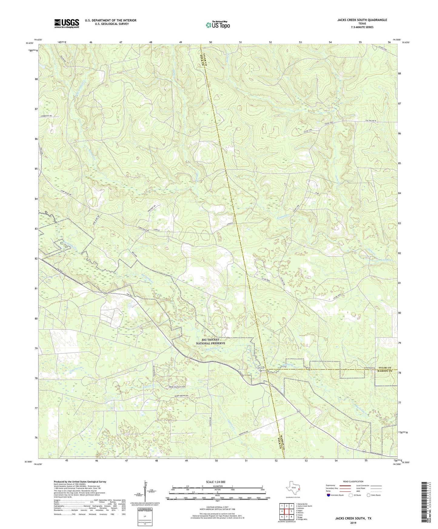
2022 topographic map quadrangle Jacks Creek South in the state of Texas. Scale: 1:24000. Based on the newly updated USGS 7.5' US Topo map series, this map is in the following counties: Polk, Tyler, Hardin. The map contains contour data, water features, and other items you are used to seeing on USGS maps, but also has updated roads and other features. This is the next generation of topographic maps. Printed on high-quality waterproof paper with UV fade-resistant inks.
Quads adjacent to this one:
West: Segno
Northwest: Dallardsville
North: Jacks Creek North
Northeast: Hillister
East: Warren
Southeast: Village Mills
South: Bragg
Southwest: Votaw
This map covers the same area as the classic USGS quad with code o30094e5.
Contains the following named places: Camp Seale, Cox Springs, Hebron Church, Jacks Creek, Little Kimball Creek, Long Branch, Oak Shade, Segno Oil Field