MyTopo
Wesley Point Texas US Topo Map
Couldn't load pickup availability
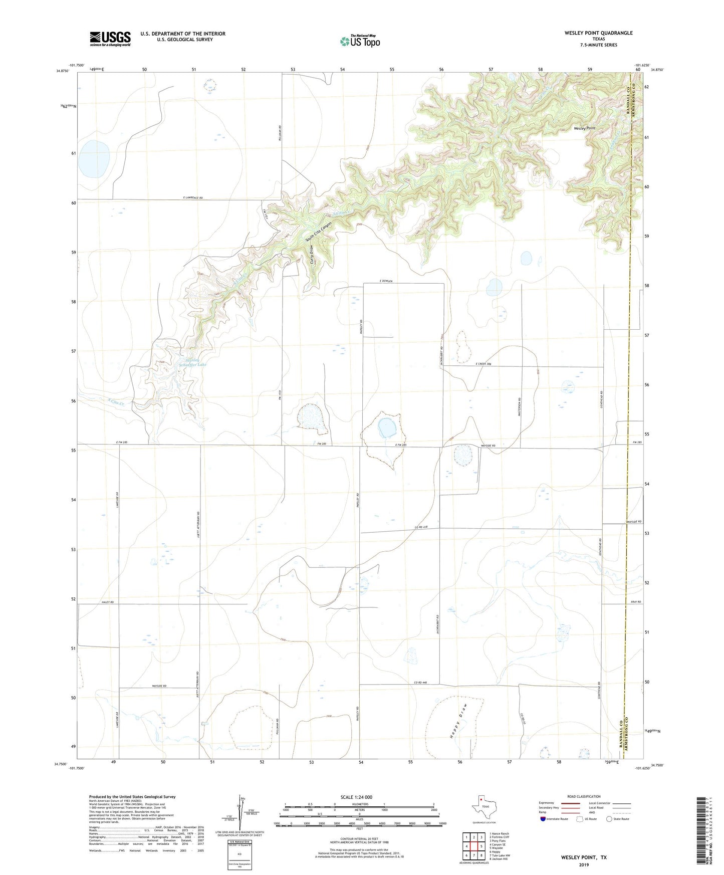
2019 topographic map quadrangle Wesley Point in the state of Texas. Scale: 1:24000. Based on the newly updated USGS 7.5' US Topo map series, this map is in the following counties: Randall, Armstrong. The map contains contour data, water features, and other items you are used to seeing on USGS maps, but also has updated roads and other features. This is the next generation of topographic maps. Printed on high-quality waterproof paper with UV fade-resistant inks.
Quads adjacent to this one:
West: Canyon SE
Northwest: Nance Ranch
North: Fortress Cliff
Northeast: Pony Flats
East: Wayside
Southeast: Jackson Hill
South: Tule Lake NW
Southwest: Happy
Contains the following named places: Cita Canyon Methodist Camp, Cita Glen Christian Camp, Curry Draw, Fairview Church, Stanley Schaeffer Dam, Stanley Schaeffer Lake, Wesley Point