MyTopo
Fortress Cliff Texas US Topo Map
Couldn't load pickup availability
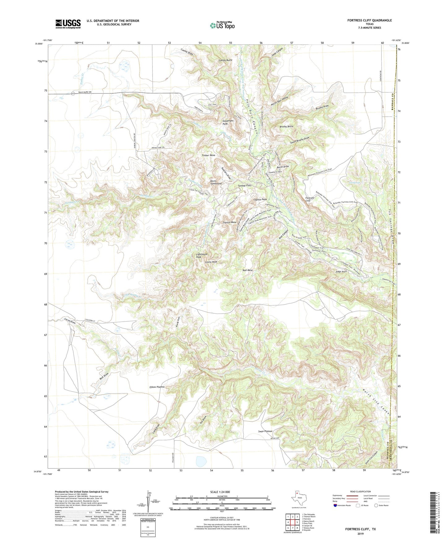
2022 topographic map quadrangle Fortress Cliff in the state of Texas. Scale: 1:24000. Based on the newly updated USGS 7.5' US Topo map series, this map is in the following counties: Randall, Armstrong. The map contains contour data, water features, and other items you are used to seeing on USGS maps, but also has updated roads and other features. This is the next generation of topographic maps. Printed on high-quality waterproof paper with UV fade-resistant inks.
Quads adjacent to this one:
West: Nance Ranch
Northwest: The Palisades
North: Thomas Ranch
Northeast: Fairview
East: Pony Flats
Southeast: Wayside
South: Wesley Point
Southwest: Canyon SE
This map covers the same area as the classic USGS quad with code o34101h6.
Contains the following named places: Brushy Butte, Brushy Draw, Bull Draw, Burnt Draw, Capitol Mesa, Capitol Peak, Capitol Peak Canyon, Castle Peak, Cooley Butte, Cooley Draw, Corral Draw, Devils Tombstone, Elbow Plateau, Fortress Cliff, Goodnight Peak, Judys Arch, Krahn Ranch, Lighthouse Peak, Little Sunday Creek, Long Draw, Mesquite Park, North Cita Canyon, North Cita Creek, North Spur Valley, Palo Duro Canyon State Park Trail, Palo Duro State Park, Pin Draw, Red Canyon, Red Mesa, Reynolds Ranch, Rustlers Draw, Seep Canyon, South Brushy Draw, South Cita Canyon, South Cita Creek, Sunday Creek, Sunday Flats, Swan Plateau, Timber Creek, Timber Mesa, Tub Springs, Tub Springs Draw, Woody Draw