MyTopo
Westover Texas US Topo Map
Couldn't load pickup availability
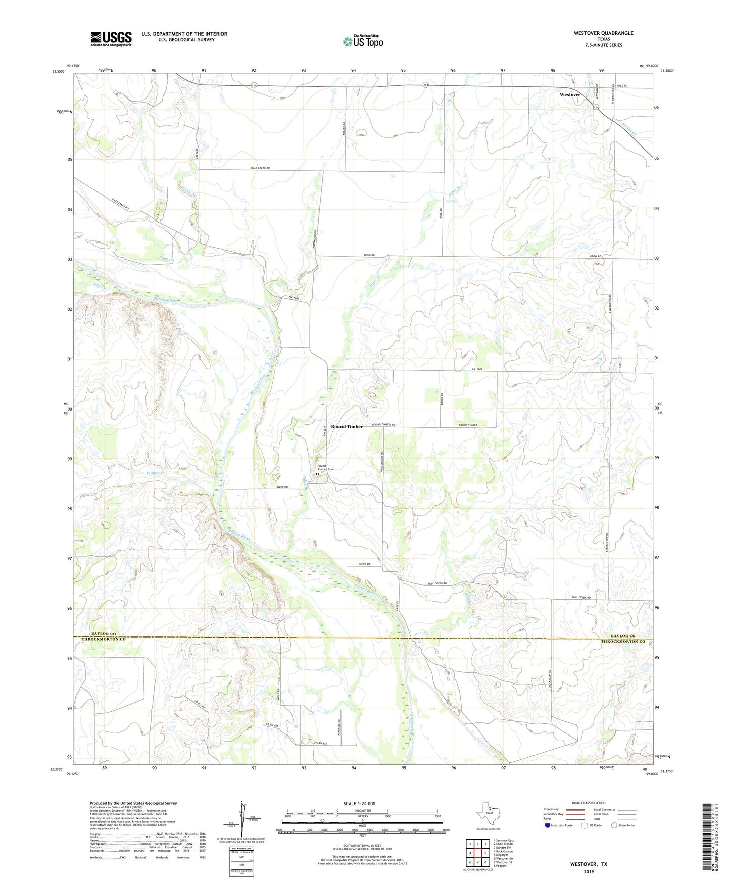
2019 topographic map quadrangle Westover in the state of Texas. Scale: 1:24000. Based on the newly updated USGS 7.5' US Topo map series, this map is in the following counties: Baylor, Throckmorton. The map contains contour data, water features, and other items you are used to seeing on USGS maps, but also has updated roads and other features. This is the next generation of topographic maps. Printed on high-quality waterproof paper with UV fade-resistant inks.
Quads adjacent to this one:
West: Rock Canyon
Northwest: Seymour East
North: Cope Branch
Northeast: Dundee SW
East: Megargel
Southeast: Padgett
South: Westover SE
Southwest: Westover SW
Contains the following named places: Aytes Branch, Bull Creek, Deep Creek, Dry Creek, Muhle Creek, Round Timber, Round Timber Cemetery, Wagon Creek, Westover