MyTopo
Aneth Utah US Topo Map
Couldn't load pickup availability
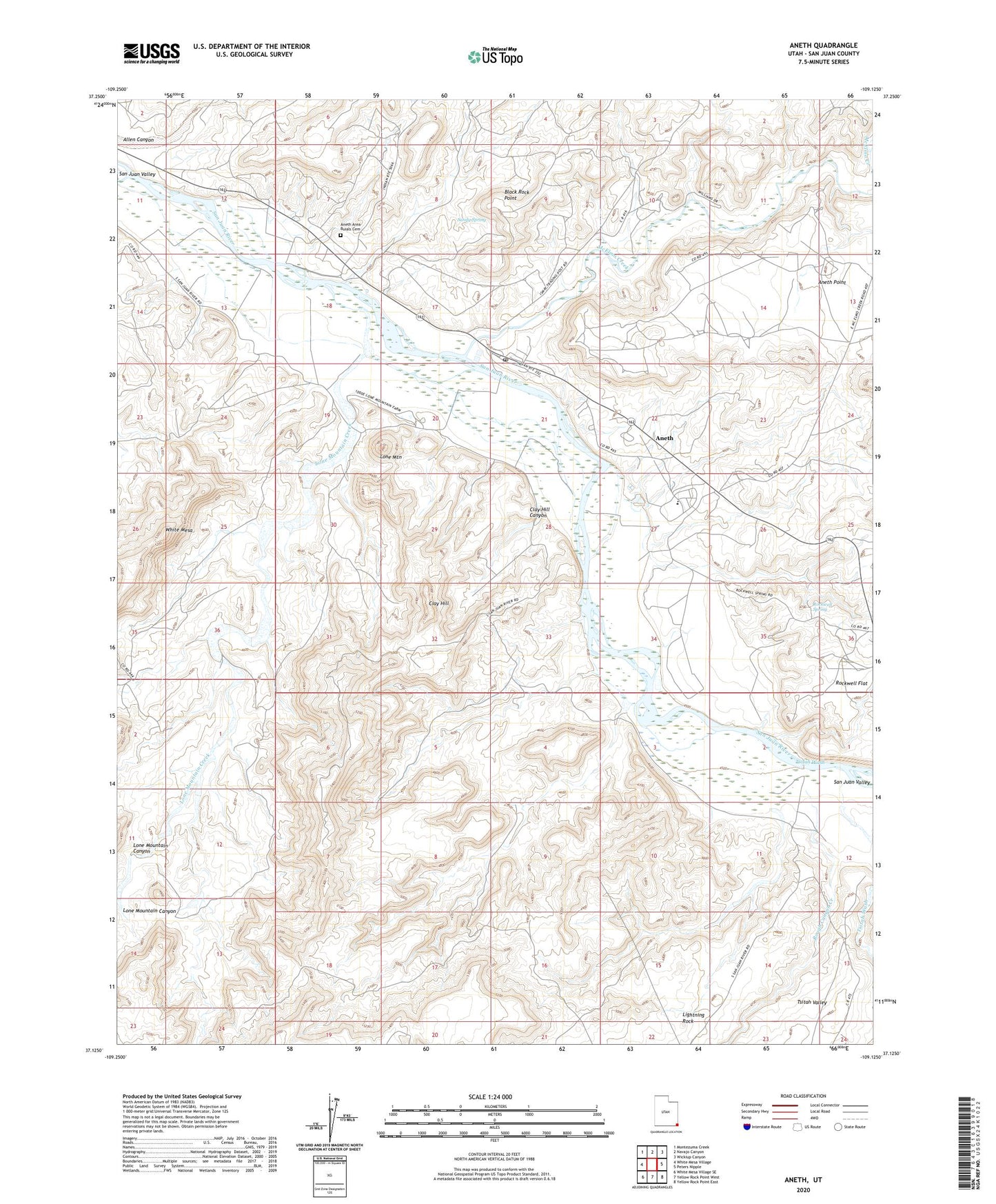
2020 topographic map quadrangle Aneth in the state of Utah. Scale: 1:24000. Based on the newly updated USGS 7.5' US Topo map series, this map is in the following counties: San Juan. The map contains contour data, water features, and other items you are used to seeing on USGS maps, but also has updated roads and other features. This is the next generation of topographic maps. Printed on high-quality waterproof paper with UV fade-resistant inks.
Quads adjacent to this one:
West: White Mesa Village
Northwest: Montezuma Creek
North: Navajo Canyon
Northeast: Wickiup Canyon
East: Peters Nipple
Southeast: Yellow Rock Point East
South: Yellow Rock Point West
Southwest: White Mesa Village SE
Contains the following named places: Allen Canyon, Aneth, Aneth Area Buials Cemetery, Aneth Census Designated Place, Aneth Point, Aneth Post Office, Black Rock Point, Clay Hill, Clay Hill Canyon, Lightning Rock, Lone Mountain, Lone Mountain Canyon, Lone Mountain Creek, McElmo Creek, Rockwell Flat, Rockwell Spring, Rough Canyon Creek, Sandy Spring, Tsitah Wash