MyTopo
Yellow Rock Point West Utah US Topo Map
Couldn't load pickup availability
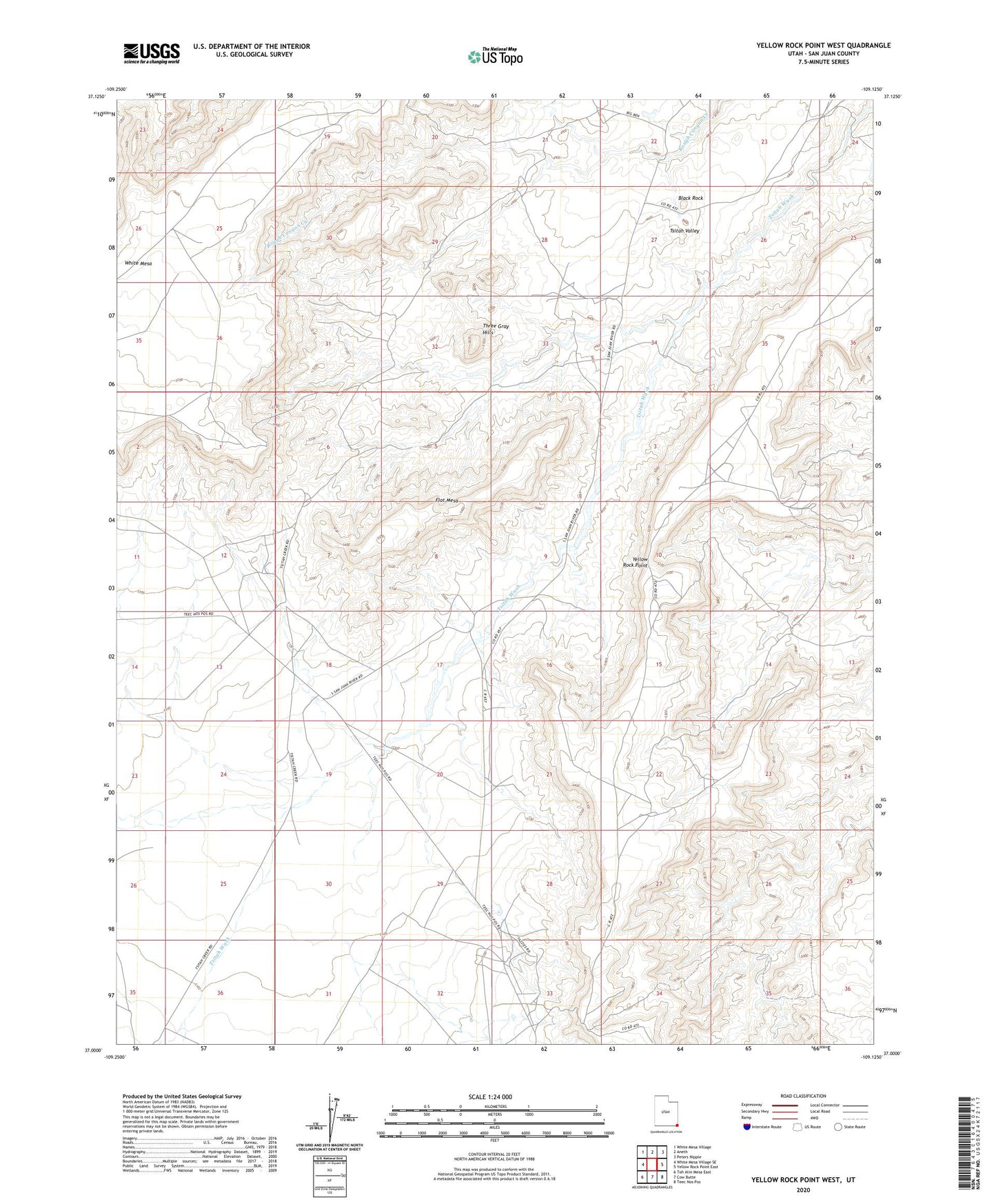
2023 topographic map quadrangle Yellow Rock Point West in the state of Utah. Scale: 1:24000. Based on the newly updated USGS 7.5' US Topo map series, this map is in the following counties: San Juan. The map contains contour data, water features, and other items you are used to seeing on USGS maps, but also has updated roads and other features. This is the next generation of topographic maps. Printed on high-quality waterproof paper with UV fade-resistant inks.
Quads adjacent to this one:
West: White Mesa Village SE
Northwest: White Mesa Village
North: Aneth
Northeast: Peters Nipple
East: Yellow Rock Point East
Southeast: Teec Nos Pos
South: Cow Butte
Southwest: Toh Atin Mesa East
This map covers the same area as the classic USGS quad with code o37109a2.
Contains the following named places: Black Rock, Flat Mesa, Morans Camp, Red Shirt Reservoir, Three Gray Hills, Tsitah Valley, Yellow Rock Point